The Cerro Cara Iguana Hike in El Valle de Anton
One of the more challenging hikes in Valle de Anton, the Cerro Cara Iguana trail is well worth your time - in this guide you’ll find everything you need to know to hike it independently.
This was our favourite hike in El Valle de Antón.
A little wild and rugged in parts, the 8km Sendero Cara Iguana loop requires a bit more fitness and spirit of adventure than other popular trails around the Panamanian crater town. This means it’s less crowded and feels more like a proper hike, rather than just a straightforward walk up to a viewpoint.
It forms part of the Caldera Route - 30 kms of interconnected trails running along the mountain ridges and crater rim - but it’s important to know that there is also a shorter but less interesting variant if you’re not sure about hiking the full loop, but still want to take in the panoramic views available from Cara Iguana.
The name, by the way, is because its silhouette is said to resemble an iguana lying down.
In this short guide, we’ll explain both options and share everything you need to know to make the decision and plan ahead for your own trip. As well as the hike essentials and practical tips from our own experience, we’ve also given a definitive position on whether you should do the loop clockwise or anti-clockwise.
This is our guide to the Cerro Cara La Iguana hike in El Valle, Panama.

The Essentials
Distance / 7-8km, depending where you start in town
Time / 3.5 - 4.5 hours
Difficulty / Moderate to challenging
Alternative / Shorter 2km out-and-back to reach same viewpoint
Cost / Free
Trail / Several steep sections, sheer drops, and lack of signage
Know / Winds can be very strong
Route / Cara Iguana map on AllTrails
How To Visit Cerro Cara Iguana
Cara Iguana is actually more of a beauty spot with panoramic views than a rugged, remote peak.
Literally called ‘The Iguana’s Face’, it’s a popular place for local families, friends, and couples to hang out on the benches or picnic on the grassy plateau, particularly at sunset.
It’s also really quite close the peaceful town of El Valle de Antón, and easy to access by car or on foot by following the same road out and up from town.
Alternatively, those who prefer to strap on a pair of boots can incorporate their visit to Cara Iguana with a longer, more challenging hike that goes along the crater rim.
We’re going to quickly summarise both options:
The Shorter, Easier Way
If you just wish to visit the Cara Iguana protected area and viewpoint (here on Google Maps), rather than have a full morning or afternoon on a relatively challenging hike, this is the best option for you.
From El Valle de Anton, simply go up the gradually ascending gravel road on foot or with private transport. When you arrive at the small yellow cabin with several route + information signs (maps), you’ll find a set of wooden stairs that will take you up to join the short, straightforward trail to the plateau and Cerro Cara Iguana (Cara Iguana Hill).
It’s about 2km each-way, and you should factor in about 45-minutes for the walk up from town at a reasonable pace.
The Hike & Clockwise Decision
Starting from El Valle, there two ways to do the 7.5 - 8km loop hike:
Clockwise | Go up the steep and unremarkable gravel road to Cara Iguana, and then continue on, along, and down through nature
Anti-Clockwise | Go up a steep trail through the wilderness, and then continue on, along, and up the crater rim to Cara Iguana before descending the gravel road
During our research, we saw several hikers on the AllTrails comments suggesting that it was much better to go anti-clockwise in order to have the hardest but prettiest parts of the hike at the start and middle, and end on the boring gravel descent. This meant that, rather than starting quite close to the Cara Iguana plateau and viewpoint, we’d save it for a crescendo near the end after two or three hours of walking.
Based on our own experience, we can confrim that the anti-clockwise logic is sound: the road descending from Cerro Cara Iguana is steep, dull, and used largely by 4x4s or quads to access the plateau and viewpoint, and going down it at the end of a quite tiring hike was definitely preferable to going up it. Whilst you are of course free to do either way (we did pass a couple of people hiking clockwise), we’d highly recommend sticking with this direction if you’re hoping to do the loop and enjoy the sunset at Cara La Iguana; there’s no way you’d want to be navigating the more difficult terrain and trail when it’s getting dark or late, whilst it’s easy to go down the gravel road at dusk.
You can find the AllTrails listing for the Cerro Cara Iguana loop here.
The Cerro Cara Iguana Loop Hike
Going Up
If you’re keen to follow in our footsteps, or go in the other direction, this is the AllTrails route map we used; it really is necessary to have a map downloaded on your phone for this hike as there are parts where it’s easy to take the wrong path.
For the anti-clockwise route, the start point is in the fancy Las Medinas area - this can be found here on Google Maps and is marked by an official route sign. This is a 25-minute walk from the town centre of El Valle, but bear in mind that it could take up to 45 minutes to reach it depending on which side of town you’re based.
As we had our rental car, we just parked up nearby. Note that if you’re doing the hike clockwise, this is where you’ll descend and end.
From the sign, it’s around a 1km walk along a narrow lane passing houses and barking dogs - thankfully behind metal fences - until you reach the quite hilariously positioned sign advising people not to drive up further by motorbike (something we’re fairly certain isn’t even possible). At this point you’ll arrive at the manmade concrete steps, where it all starts to become very steep and very sweaty quite quickly.
This will probably be the most tiring part of the day, so feel free to go at your own pace and have a few stops to appreciate the views over El Valle (albeit with the whining, high pitch soundtrack of shrill cicadas and strimmers).
Quick tip - don’t have a big lunch just before starting.
Distance | 2km
Time | 55 minutes


The Main Section
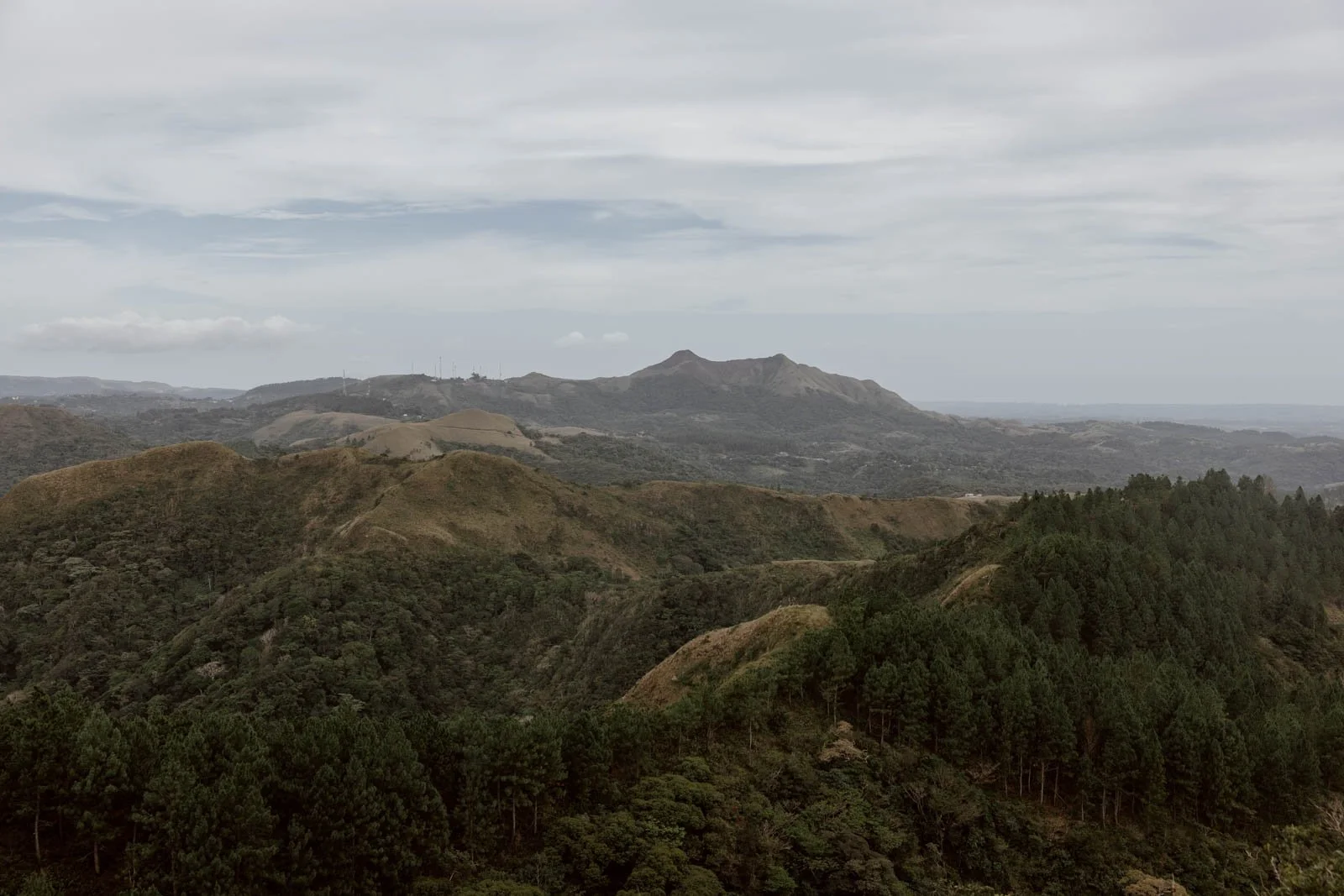
Eventually, the trail opens up to look out on a very Scottish scene of planted pine trees and hills - something quite different to the lush, tropical vegetation of the El Valle crater. Continue on and you’ll reach a large sign for the Cerro Cara Iguana Hike with a map showcasing the various nearby routes, and a bench upon which you can take a well-deserved break.
This juncture is also the start (or end) point of the Macano - La Silla trail.
If you have time, we recommend continuing on straight for a minute or so to enjoy views of an endless horizon, then go back to the sign to rejoin the Cara La Iguana trail proper.
The trail wasn’t immediately obvious due to how overgrown everything was: to avoid confusion, stand in front of the sign and you’ll see the trail up and to the right, heading through the grass and beyond.
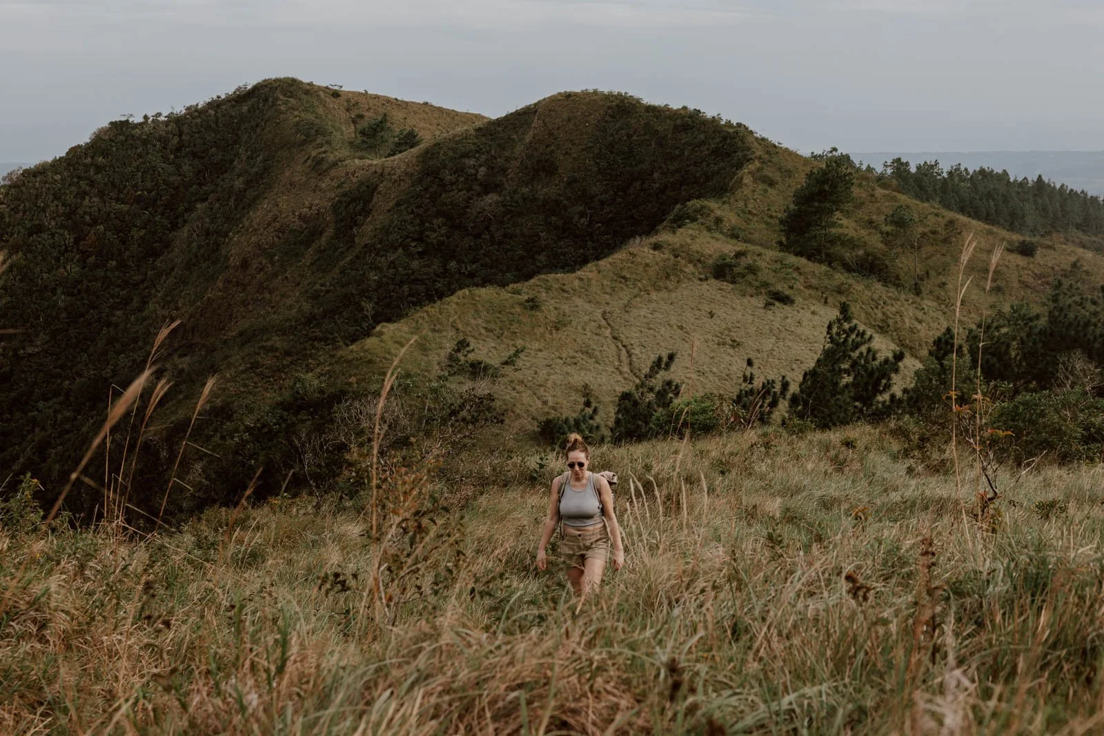
This is when it all became a bit more of an unexpected, challenging hike for us.
Vegetation covers much of the trail (clearly this hike isn’t nearly as popular as others in the area) and it was quite steep in sections, with a little bit of scrambling involved. There were no further signposts nor any tracks or clear signs of which was the correct way to venture, and several sheer drop sections on the crater ridges that you only realised when you were approaching them and already quite close. The winds were also very strong, which was a little disconcerting at times - and the reason we don’t have many photos of this hike, preferring instead to keep our cameras safely stowed inside our bags.
These aren't said as negatives though - the views were STUNNING and we both got that adventurous 'this is why we hike' feeling. If you’re thinking that sounds outwith your comfort level, then perhaps consider doing the clockwise route, which will be all descents on this part and beyond.
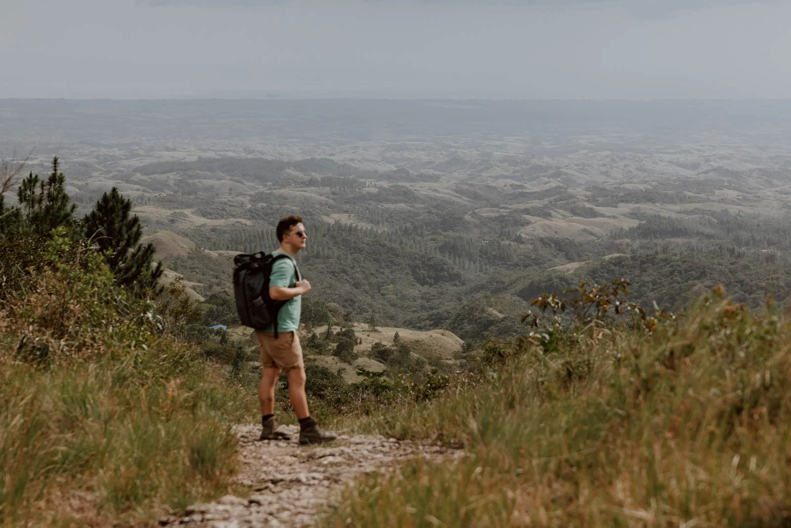
After walking along the crater rim for a while, the relative wilds of this section abruptly end and you’ll come a clear opening with benches and probably a few families or non-hikers enjoying the views of Cerro Cara Iguana and the grass-covered surrounds.
The plateau is well-kept and photogenic, and a good place to take a break, enjoy a packed lunch, watch the circling birds, or settle in for sunset.
Distance | 2km
Time | 1h 20 minutes
Know | GPS and a downloaded map is essential for this section as it's very easy to lose sight of the trail at a couple of turnings and continue in the wrong direction. We lost our way a couple of times as we weren't paying attention, and needed the reference point to get back on correct path.
Also, make sure to look back at various points in this section, as the nicest backdrop or view is sometimes behind you!
Going Down
Once you’re finished up on Cerro Cara Iguana, it’s an enjoyable 10-15 minute walk down a gravel path to a yellow hut. Although this has various new information signs on hikes and the area on the outside, it doesn’t appear to be open any longer.
Go right at the hut, and follow the wide gravel path all the way down. As we mention earlier, it’s a bit of a dull walk to be honest, and the road is used by cars, people in 4x4 buggies, and walking locals heading up to the area from which you’ve just come. However, if you’ve found the previous two sections a bit tiring, the predictable terrain and downward trajectory will be welcome.
Once you reach the outskirts of El Valle, you’ll come to road after road lined with sprawling estates, faux-stately homes and recreational horse stables - a reminder that this town is an enclave for the Panamanian elite - before eventually joining Avenida Los Millionarios from where you’re about 20 minutes back into the centre of El Valle.
If you’re anything like us, then at this point you’re probably gasping for a cold beer or two, and we’d suggest heading straight to Ruta 71 (maps)
Distance | 3km, but we actually walked another 1km in order to return to our car
Time | 1h 10 minutes
Plan | Want to know what else to do after your hike? Read our El Valle travel guide (published soon)


Bring
In terms of footwear, we definitely recommend wearing your hiking boots. These are an essential for travel in Panama and Central America more generally, so you definitely should be bringing some along with you. If not, a decent and sturdy pair of sports trainers would manage the loop, but your ankles won’t have as much protection.
Andrew almost always wears shorts on hikes, but trousers would have been a better bet for Cerro Cara Iguana. It’s very overgrown in the middle section, and his legs got dozens of itchy bites / spots from either a plant or bugs at some point up there.
We also really want to stress the risk associated with the proximity to the crater rim on this hike - it’s a sheer drop, with no rails and little warning before you realise that you’re actually quite close to the edge. In poor visiblity, such risks would increase substantially - and this is why it’s important to have the AllTrails map with you.
The strong winds up there also make things a little more wild and bracing!
You’ll need plenty of water as there are no shops or fill-up points along the way and, ironically for a water reserve, we didn’t come across any freshwater sources to top up our trusty Water-to-Go water bottles (use the code ‘ADR15’ for a wee discount if you buy one - we highly recommend them!).
A few other essential we suggest packing:
· Snacks
· Insect spray
· Suncream
· A layer
· Some cash
· Headtorches, just in case
· Fully-charged mobile phone
· Battery pack if you have one

Travel Better in Valle de Anton
A Guide to Valle de Anton | The Best Things To Do