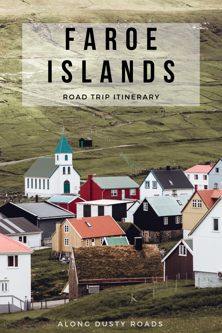
The Perfect 7-Day Faroe Islands Road Trip Itinerary
The Faroe Islands.
A small cluster of islands in the Atlantic Sea, for years largely ignored by international tourists, has burst on to the global stage; it’s magical landscapes quickly making it the next place to go for those that feel Iceland has gone too far.
We spent seven wonderful summer days on road trip criss-crossing the Faroes and in this post, we’re sharing our own one week Faroe Islands itinerary (with a day-by-day breakdown), alongside our advice on how best to experience the islands, recommendations on where to stay, plus potential additions or tweaks to the itinerary we would recommend to help future visitors to plan the very best Faroe Islands road trip!
This is our Faroe Islands Road Trip Itinerary.
(updated February 2025)
Is a Road Trip The Best Option For Exploring the Faroe Islands?
In short, 100% yes!
Over seven nights and eight days, we drove along winding single-track roads, through dark tunnels blasted into rock or under the sea, past many many sheep, towards gorgeous little villages, on dramatic blind hairpins, and always with an epic Faroese view just ahead of us or in the rear-view mirror - we absolutely loved it.
Indeed, much to our surprise (and likely others), The Faroe Islands are uniquely well set-up for a road trip and the perfect destination for an adventure by car. The main islands are incredibly well-connected by a series of tunnels and bridges, the road conditions are pretty great, and the distances each day are manageable (with a drive time of only two hours from east to west).
Additionally, having your own rental car also allows you to venture towards some of the most remote spots within a destination which is already, well, pretty remote.
An important thing to be aware however - as we outlined in our ‘Faroe Islands Travel Budget’ post - is that a road trip here ain’t cheap, with one week’s car rental costing at least £500 - £600 before fuel costs. In fact, it’s important to note at the outset - before you get your heart set on visiting - that the Islands really aren’t a destination for budget travellers in general due to the price of accommodation and meals. Public transport exists in the Faroes, but the limited schedule and coverage will notably restrict your ability to travel across the islands in a week or less.
This fact, combined with the above, means that there is no doubt in our minds that a road trip (or cycle trip) is the best way to experience and travel the Faroe Islands.
If you are reading this post to help shape your own itinerary, but don’t plan on taking a road trip or prefer local tours, then we do recommend that you continue reading but you may also like to check out our ‘10 Things to See in the Faroe Islands’ post (published soon, we promise!) for some additional inspiration.
Travel Tip // You can take a look at the best car rental deals in the Faroe Islands here.
Our Essential Tips for Driving in the Faroe Islands
We have written and entire guide full of advice on driving (and renting a car) in the Faroe Islands, but wanted to share the main takeaways in this post too, as whilst navigating these small islands is nothing like taking on Sicily, there are a few important points to note from the outset.
Car Rental | As we mentioned above, car rental is pretty pricey, and as there are only a limited number of rentals available, we’d recommend getting this sorted as soon as possible. There are a few companies in operation, but you can find an overview, check prices and book here but be sure to also check out AutoEurope or RentalCars as they often have some great value deals.
Oh, and don’t bother with the rental company’s insurance - opt for an annual excess policy like this one
Fuel Stop | Unsurprisingly, they’re not terribly abundant here, so be certain to fill keep your tank at least a third full at all times.
Faroese Fog | Honestly, this stuff is no joke with visibility reducing to almost nothing very quickly. For this reason, it’s required by law to keep your lights on at all times - even on a lovely, sunny day.
Sheep | With more sheep than people in the Faroe, you should drive like you’re expecting one to jump out
Speed Limits | Across the island, the speed limits (unless indicated otherwise on a sign) are 50 km/h in built-up areas and 80 km/h on main roads.
Tunnels | Through rock and under the sea - there are several tunnels on the Faroe Islands, and you’ll almost certainly have to drive through a few:
· Always have you lights on
· Take them super slow
· If you don’t have right of way (this is indicated on a sign before you enter the tunnel), you’ll need to use passing places if there’s oncoming traffic. The exception to this is if a truck is coming through at the same time, in which case you’ll have to pull over irrespective of whether you have right of way.
· When exiting the tunnels, use the mirrors to note any oncoming traffic that may not be aware of you.

Our Perfect Faroe Islands Road Trip Itinerary
When planning a road trip route and travel itinerary in the Faroe Islands, it is best to first split the islands into their component parts.
The larger islands of Vagar and Streymoy in the west, and Eysturoy in the middle, will feature on every visitor’s itinerary due to their accessibility and attractions. Travellers with more time, or looking to do the famous lighthouse hike, will also include one or two from the smaller cluster we call the ‘Northern Islands’ (composed of Kalsoy, Kunoy, Bordoy, and Vidoy for the purposes of this post).
Following our itinerary, you will visit each of the above in a route which doesn’t involve too much ‘doubling back’ on yourself or rushing, whilst it limits time in Torshavn - the capital city - to just three nights; if you are road tripping for three to four days then you will have to either go at a much quicker pace than we did (not recommended) or simply remove some locations to make a more manageable and desirable route that still allows you to have a wonderful Faroese experience.
The Itinerary Overview
Day One | Check into hotel on Vagar Island with a little island exploration if you arrive early.
Day Two | Explore Vagar - Mulafossur Waterfall, Trælanípan Lake and Trøllkonufingur. Stay at Hotel Føroyar.
Day Three | Explore Streymoy - Tjørnuvík, Fossá Waterfall, Saksun and Kirkjubøur. Stay at Hotel Føroyar.
Day Four | Head to the northern islands with stops at Slættaratindur, Gjógv, and Funningur. Stay in Norðdepil at this harming little cabin
Day Five | Explore the northern islands of Kalsoy and Vidoy. Stay in Norðdepil.
Day Six | Chilled day in Torshavn. Stay at this delightful Airbnb or Havgrim Seaside Hotel 1948.
Day Seven | Day trip to Mykines. Stay in Torshavn.
Day Eight | Make your way home
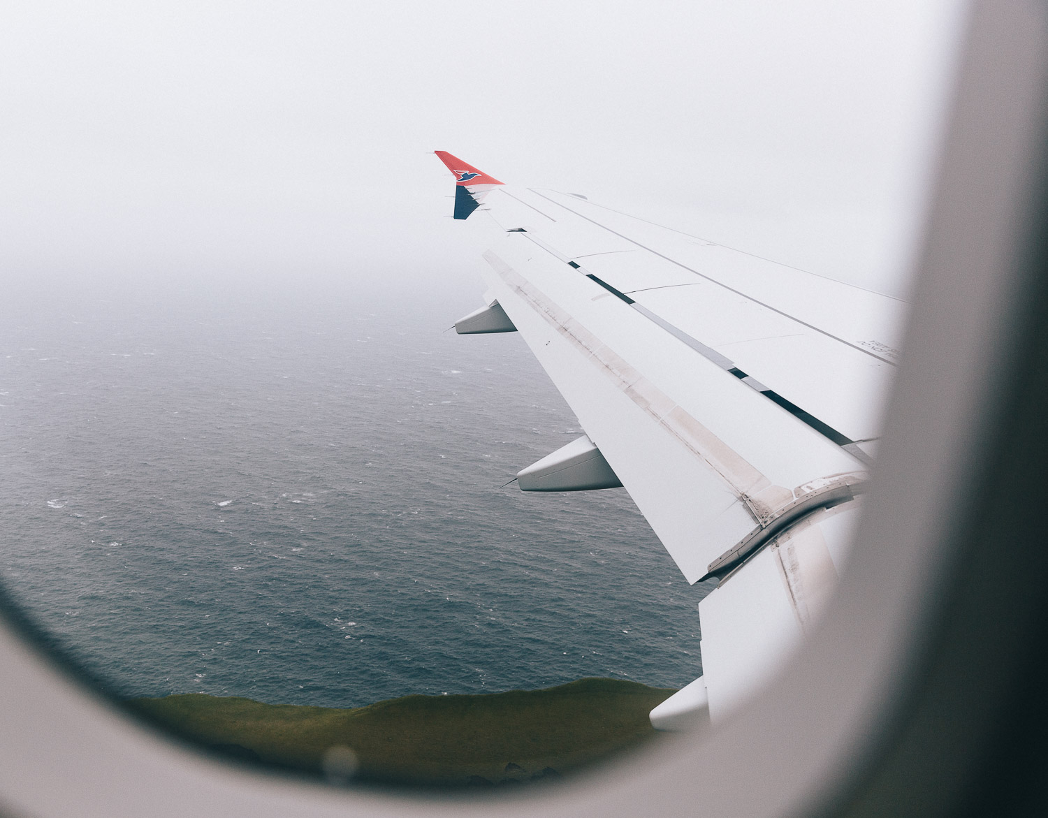
Day One | Arrival at Vagar Airport
Vagar Airport (maps) is the Faroe Islands only airport, and so it is inevitable that the almost all trips will start out here; it is also the best location to pick up a rental car (which you 100% need to book in advance - read more here).
Four airlines currently serve the Faroes: Atlantic Airways, Scandinavian Airlines (SAS), Icelandair, and Widerøe. Atlantic Airways remains the main carrier, flying direct from Reykjavík, Edinburgh, and Bergen (about one hour), while both Atlantic Airways and SAS operate regular routes from Copenhagen (around two hours). Widerøe connects the islands with Bergen and other Norwegian cities, and Icelandair also links the Faroes with Keflavík International Airport.
Our flight from Edinburgh arrived in the late afternoon, meaning we had little time to explore the island that day. If your flight lands earlier, you could easily kick off your road trip straight away - or even fit in a short hike on Vágar before heading to your first stop.
Where We Stayed | We based ourselves at Hotel Vagar for the first night, a lovely modern hotel which literally couldn’t be any closer to the airport.
Many travellers, however, head straight to Tórshavn (maps), using the capital as a base for their entire trip. We considered this when planning our route but dismissed it as the independence of a road trip is, for us, an opportunity to stay outside of cities, spread the positive impact of tourism more evenly across a destination, and also to spend nights in remote or lesser-visited locations.
If you’re spending your first night on Vágar, a couple of solid alternatives are:
Giljanes Hostel / With dorms, camping sites, plus a few basic private rooms, this is an affordable, clean, comfortable and well-located option close to the airport.
Guesthouse Hugo / Next to the sea, this is a welcoming B&B run by Maria and Kent. It only has two single rooms and two doubles however, so early booking is essential.
Driving Time | Maximum of 2 hours
Day Two | Explore Vagar
Our original itinerary had us visiting Mykines on our first full day in the Faroes.
Unfortunately however, the weather Gods had other ideas, and this was not to be (read our guide to Mykines to understand how common this is). Instead, we threw on our hiking boots and set off on a hike towards the village of Gasadalur, located here on Google Maps.
This tiny village hidden by the sea was once only accessible to those willing to hike up and over a mountain, along the old Postman’s trail - so that’s the way we went (instead of simply driving through the tunnel that now connects it to the rest of Vagar). Reaching the impressive Mulafossur (maps) after a few hours sweating makes the epic views even more impressive!
To learn more about the hike, or plan your own, see our guide.

After lunch, we zipped along the empty roads to hike the famous ‘floating lake’ at Trælanípan (maps).
Yes, that famous Instagram lake is actually only a five minute drive from the airport. You may even be fortunate enough to get a stunning view of it on the flight into Vagar - be sure to book that window seat!
It’s a very manageable three kilometre walk to the main viewpoint where the lake meets the sea but trust us, there’s more beautiful scenery here to savour slowly than simply rushing straight up the hill.
Entrance to the trail is now 200 DKK, payable online and walking time is roughly two hours return.
If we arriving on the Faroe Islands in the early morning or afternoon, then this is hike we’d opt to do on Day One. We’re in the process of putting together a guide to this very place, so stay tuned.
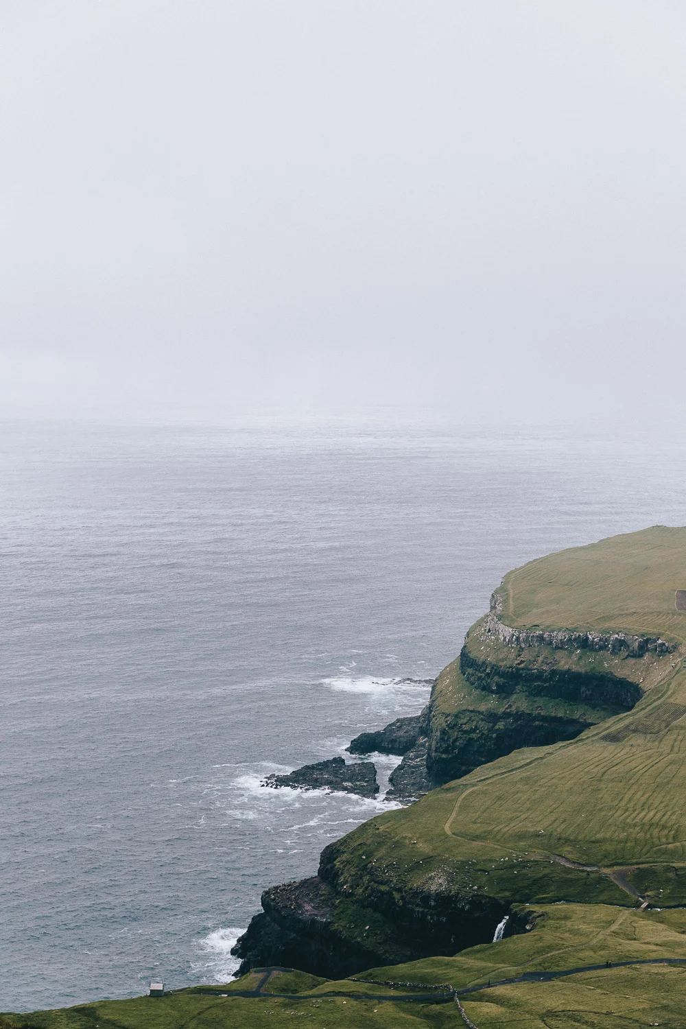
A short drive from Trælanípan car park, and a sensible next stop, is the photogenic Trøllkonufingur (maps), a striking rock spire said to be the petrified remains of a witch who tried to throw the Faroe Islands to Iceland. The road up to Trøllkonufingur is a little bumpy at times, but you can easily park at the top and take the short walk.
Where We Stayed | At the end of Day Two, we drove along the sub-sea tunnel towards Torshavn for a night at Hotel Føroyar, a large, modern grass-roof building overlooking the city and the sea below. As Torshavn has most of the eating out and accommodation options in the Faroes, as well as most of the people, it’s likely that you will spend at least 1-2 nights in the city; we’ve created this short Torshavn City Guide with ideas on the best things to do, where to stay and our favourite restaurants for every budget.
Driving Time | Maximum of 2 hours
Travel Tip // Check ssl.fo or ask your hotel reception for updates on ferry or helicopter cancellations to Mykines the night before Note that the ferry to Mykines leaves from Sørvágur, a small town on the island of Vagar. Due to the likelihood of a cancellation, we recommend you have an idea about what your own ‘plan B’ will be, just in case!
Day Three | Explore Streymoy
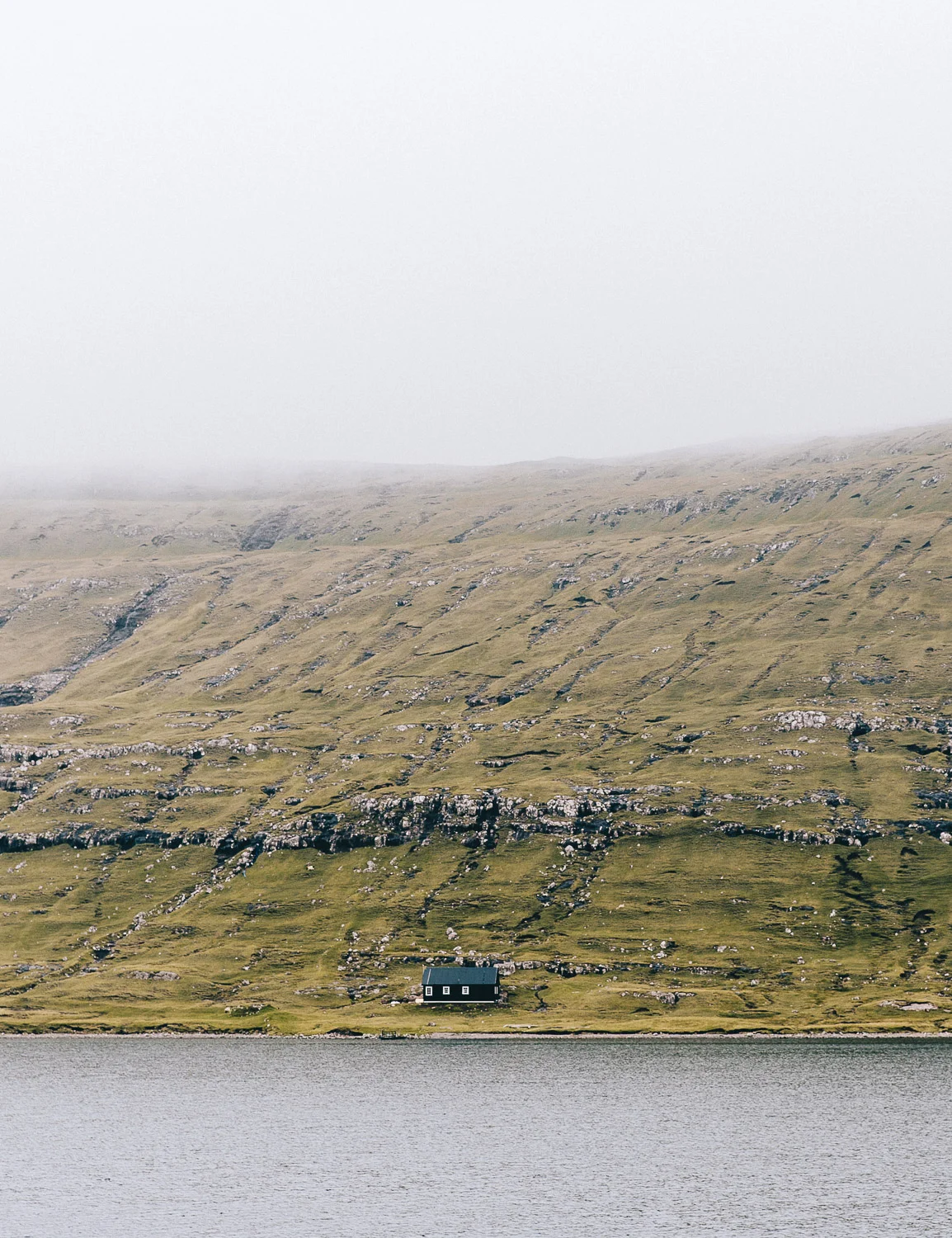
We awoke on our third morning to thick fog, so indulged in a long breakfast and headed out to explore the island of Streymoy (maps), the largest of the Faroes.
From Torshavn, we snaked our way along a high and winding single track road to the picturesque village of Tjørnuvík (maps), at the very north of the island. Tiny and quaint with a population of around 60, it’s definitely worth adding to your list of ‘cute Faroese villages you’ve got to visit’. There’s a pretty beach, a small car park and, unusually for the Faroes, a coffee shop.
Good to Know // The best photo of Tjørnuvík is from the high road just before you reach the village, where the houses curve around the bay below. There’s only space for a quick pull-over, so take your shot, soak it in, and keep moving.

Having somehow missed the rather impressive Fossá Waterfall (maps) on our way to Tjørnuvík (we blame the sheep just dying to have their photo taken on the opposite side of the road), we made sure to stop on the return journey. Dropping more than 140 metres in two tiers, Fossá is the Faroes’ tallest waterfall and one of its most photogenic. And whilst the rocks are quite slippy to traverse, with care you can clamber relatively close to the water without causing any damage to yourself, or the surroundings. Note that there is only space for a handful of cars to park safely here in the spaces provided so don’t linger too long.
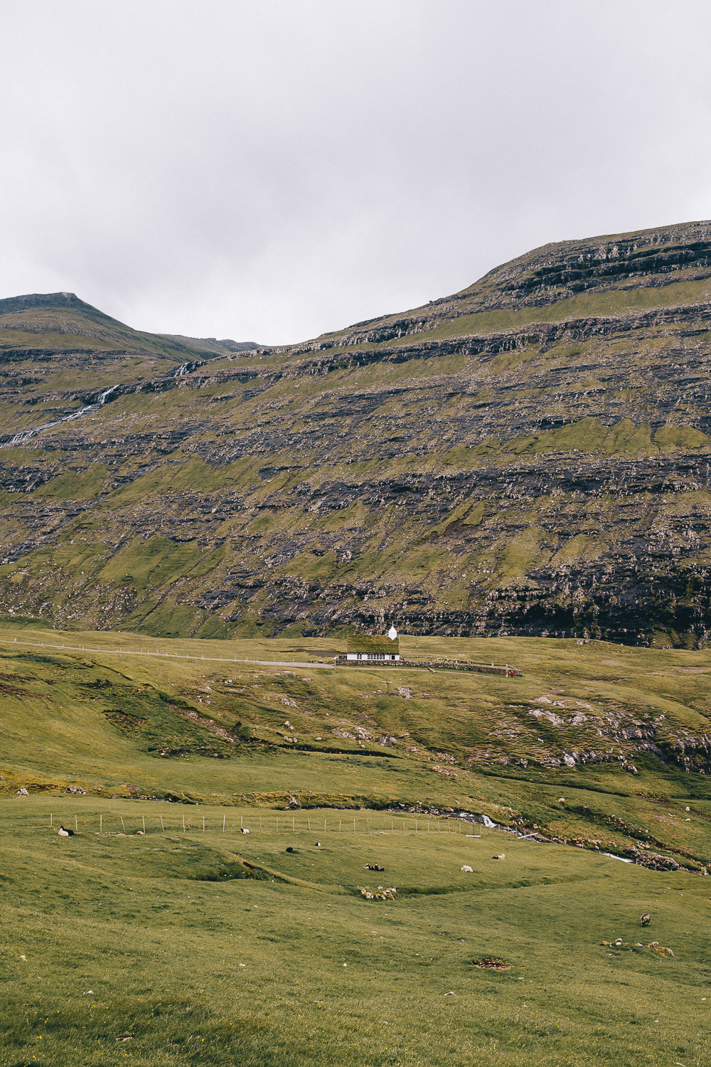
After this, we continued west toward Saksun (maps), along perhaps one of our favourite stretches of road in the Faroes. Wide open spaces flanked by imposing mountains, the odd house dotted across the landscape and not another car in sight; the drive to Saksun is breathtakingly beautiful, and will be so whatever the weather conditions - take it slowly and savour it.
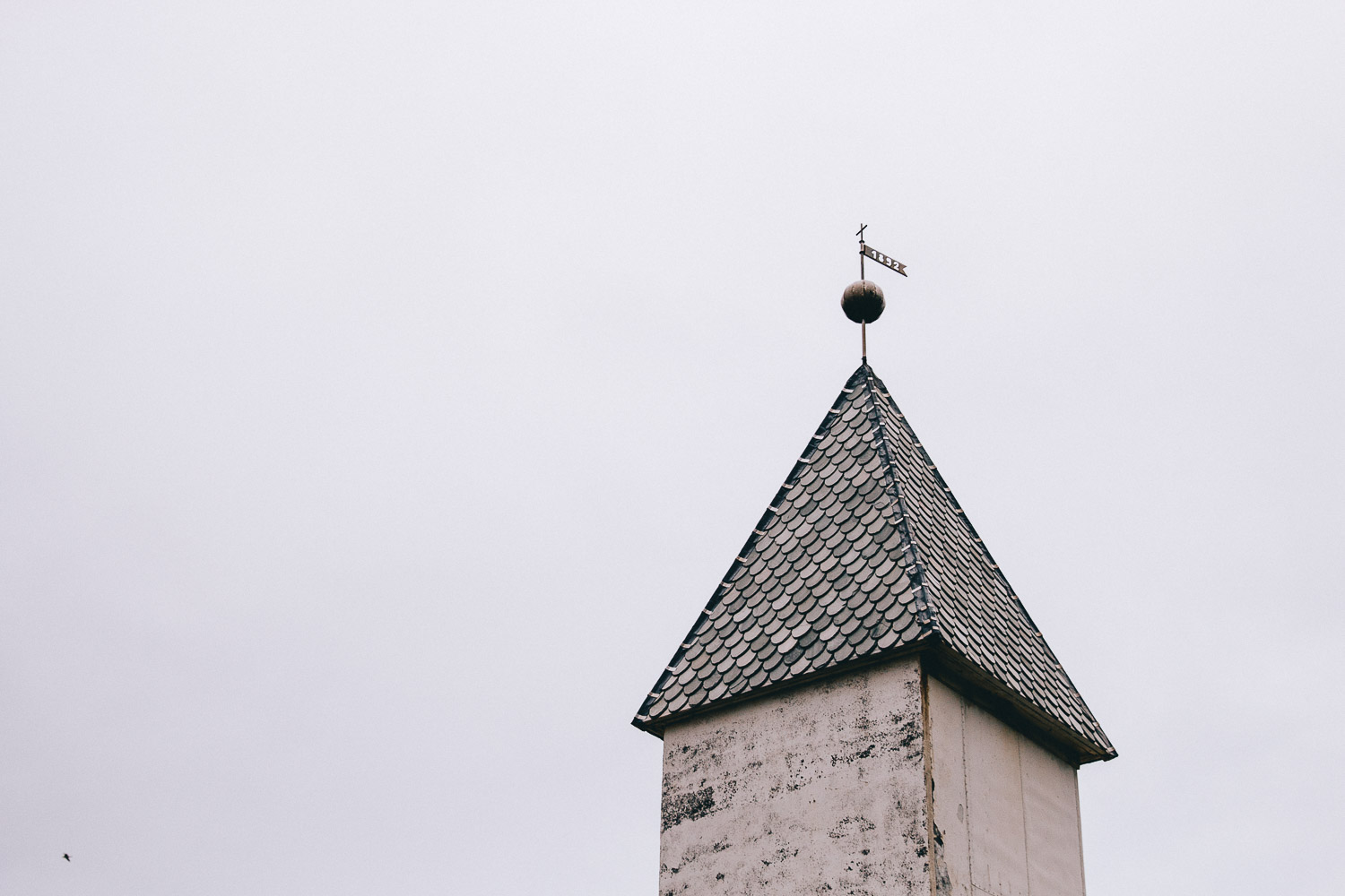
The village itself is really just a collection of a few houses, huts, and a beautiful white church overlooking the water, but this belies the majestic location of it all and the beauty of the traditional Faroese grass-roofed homes nestled amongst the grass. It really is a stunning location, and you’ll soon realise why it’s such a popular place to visit in the Faroes.
There are three parking locations in Saksun but be aware that these can fill up quickly in high season; we recommend heading right as you approach the town which will bring you to the largest and then making your way to the little museum and cafe run by a local farmer and his partner across the road. Coffee stop opportunities are few and far between in the Faroes and we will long remember sitting in this cosy little old farmhouse, away from the wind chatting with the owner about how tourism is impacting the Faroes (both for the good and the bad).
Beyond the village, it’s also possible to take a short, picturesque walk down to the beach. When we visited, this was free but it appears that a fee may now have been introduced (please let us know in the comments if you visit and can confirm). The access point for the walk is easily found by taking the left fork as you approach Saksun, or you can just walk to it from the car park mentioned above. Note that if the tide is high, the walk unfortunately becomes inaccessible.
The last port of call for our day of Steymoy exploration was Kirkjubøur (maps), the southernmost village on the island. In addition to being pretty damn photogenic, it’s famous for being home to the most important historical site in all of the Faroes - the the roofless stone ruins of St. Magnus Cathedral - as well as the 12th Century St Olav’s Church (the oldest still functioning Church in the Faroes) and the world’s oldest inhabited wooden house, an 11th century building which is now a museum.
Definitely worth a visit!
Where We Stayed | Hotel Føroyar in Torshavn.
Driving Time | 4-5 hours
Travel Tip // When visiting these small communities in the Faroes, be respectful and considerate of the space and privacy of those who call it home. In Saksun - which is almost entirely private land - there is a real problem with visitors trespassing to take photos of a certain house from a certain angle and this is not welcomed by the owners (nor should it be). Be a responsible traveller and remember that no photo is worth ruining this place for the people who live here, or the people who visit in future. Note than drone flying is also strictly regulated.
Day Four | Make Your Way To The Northern Islands
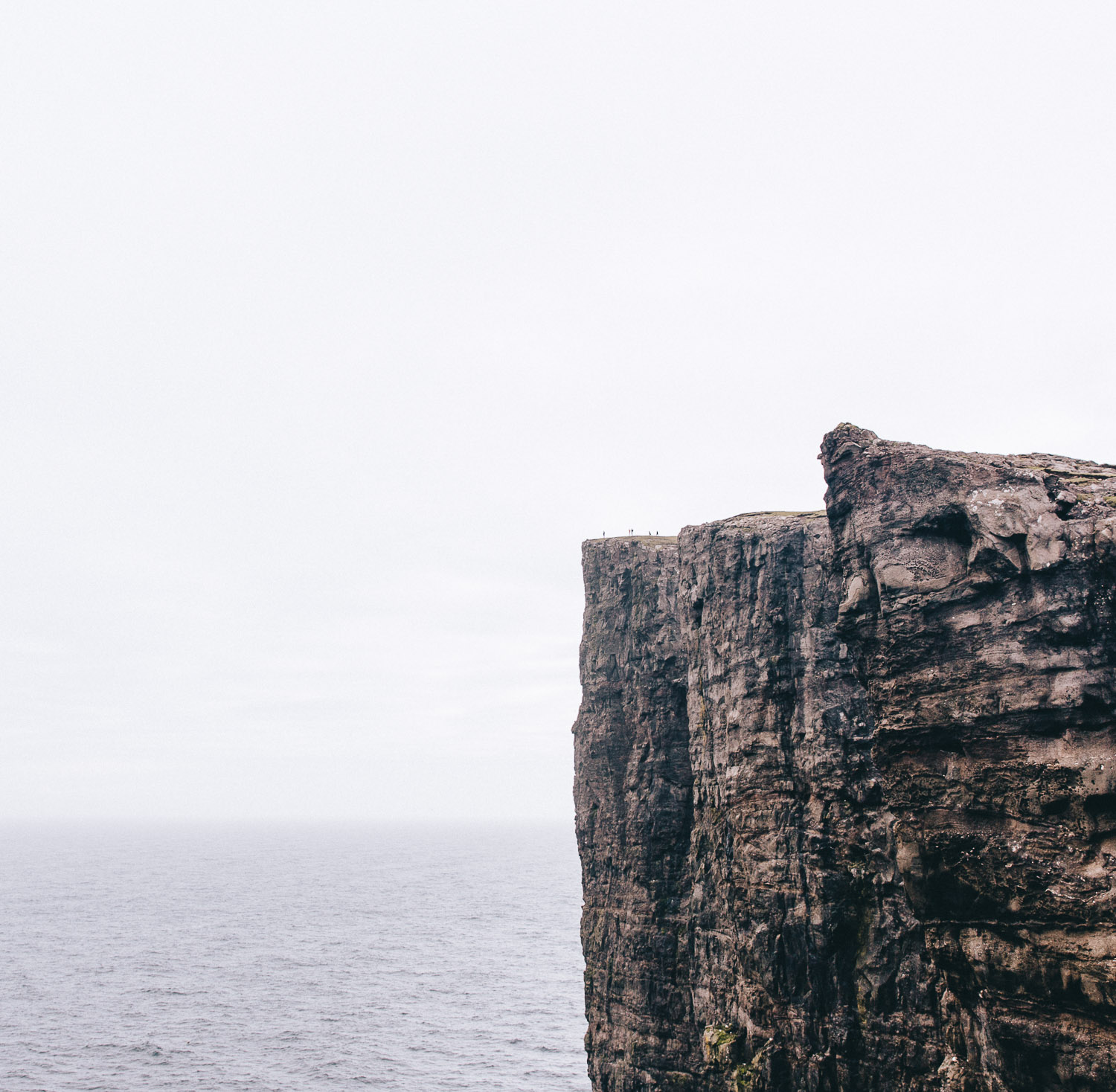
As we mentioned earlier, while many travellers base themselves in Tórshavn for their entire stay (and do day trips), we felt it was important to spend a few nights in the Northern Isles. Our plans had initially included the beautiful four hour hike of Villingardalsfjall on Viðoy but - in true Faroese style - the weather had other ideas. So we pivoted, Ross-style, and aimed for Eysturoy (maps) instead.
Crossing the Streymin Bridge, we followed the winding mountain pass towards Slættaratindur (maps), which at 880 metres is the highest peak in the Faroes. The road climbs through beautiful, wind-whipped scenery (watch out for sheep darting across the tarmac), including a viewpoint over one of the fantastic Faroese football pitches and a lovely secluded spot with binoculars looking out at the ‘Witch and Giant’ rock formations off Eiði.

From the Slættaratindur trailhead at Eiðisskarð (maps), you can either tackle the steep climb to the summit - about 2 km each way - or keep driving on to Gjógv (maps), a charming village on the island’s north-eastern tip, known for its deep natural harbour and colourful cottages. It’s gorgeous, but the first place were we felt that the balance was slowly being tipped from peaceful village into tourist stop.
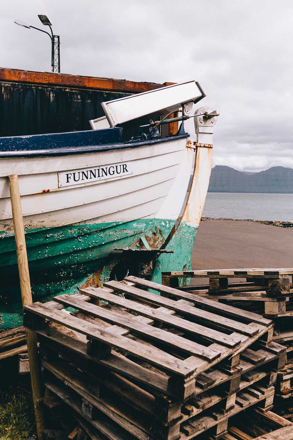
After Gjógv, double back to take the sharp right-hand turn (watch the blind corner) down into Funningur, a quiet valley village surrounded by steep green slopes. It’s one of the prettiest drives on Eysturoy - short, slow, and spectacular.
You can also reach this area either via the Eysturoy Tunnel, a subsea route from Tórshavn (toll is 175 DKK each way). Both options are scenic, but the bridge keeps you above water, and closer to those spectacular mountain views.
Where We Stayed | We opted to base ourselves in an Airbnb in Norðdepil, a town on the east coast of the island of Borðoy. Unfortunately our specific accommodation is no longer available, but this charming little cabin or this one are excellent alternatives.
The further out of Torshavn one travels, the fewer accommodation options are available, but there are several options on these Northern Islands if you take the time to look on Airbnb and Booking.com.
Driving Time | 4-5 hours
Travel Tip // If, when you’re done with your day of exploring you need to warm up, be sure to pop by Fríða Kaffihús (maps), a lovely little coffee shop in the town of Klaksvik. It was probably the most expensive chai latte we’ll ever consume, but damn it was good! It’s also one of the few places we found non-dairy milk.
Day Five | Explore The Northern Islands
An early morning start saw us driving back to Klaksvik (we may or may not have had another cup of coffee at Fríða Kaffihús….) to catch the 10am ferry to the island of Kalsoy, home to just 60 or so people and one of the Faroe’s most popular hikes: the Kallur Lighthouse trail (maps).
Previously first-come-first-served, the Kalsoy ferry (Route 56) now allows advance online booking, which is what we’d recommend in summer or on bright, calm days when the hike is at its most popular. Any unbooked space is then taken by cars in the queue, but relying on turn-up-and-go is no longer a sure thing in July/August.
The 20-minute crossing drops you in Syðradalur, and from there it’s a gorgeous drive through the island’s tunnels to Trøllanes and the start of the trail where you’ll need to pay an access fee. This costs 200 DKK per adult, 100 DKK for teens and is free for kids up until 12 and is used to help maintain the path and cope with visitor numbers.
This short two-hour round trip hike provides epic views over the ocean, and a little work-out for bodies that may have spent too long sitting in a car seat. You don’t need a guide, but you do need to stick to the marked route, and the cliffs are still completely unfenced.
We’ve written an entire post on this wonderful day trip, so be sure to hop on over to help plan your time on Kalsoy.

When we returned to Bordoy, the weather and the light were still holding, so we continued our exploration of the Northern Islands. Beginning with Viðoy, we drove over to the quaint village of Viðareiði (maps), the northernmost settlement of the Faroes. Most well-known for its photogenic church, it also provides fantastic views of Villingardalsfjall.
Vidoy is small, even by Faroes standards, and driving the route around its coast should take no longer than an hour (including a few stops for photos).
Before heading back to our summerhouse for the night, we we drove north from Norðdepil, along one of the many ‘Buttercup Routes’, to the abandoned village of Múli (maps). With no permanent residents for decades, and only a couple of holiday homes, it is bewilderingly quiet and provides those who venture down its bumpy roads with time to simply sit, and watch, listen and enjoy, a stillness that is rare these days.
Where We Stayed | We spent a second month in the same Airbnb as the previous night.
Driving Time | 4-5 hours
Top Tip // With the super long days that exist in the summer on the Faroes, it can be easy to ignore the clock and rely on the light as a guide to when you should go to bed. This is wonderful for fitting in as much as possible to your waking days, but as most itineraries here involve a lot of ‘doing’, be sure to have enough rest - as difficult as it is to go to sleep when it’s still light out!
Day Six | A Chilled Day in Torshavn
With a lot of driving under our belts, and a fair bit of hiking (although not as much as hoped), we took the opportunity to rest up in Torshavn and properly explore one of the the smallest capital cities in the world.
Compact, creative, and deeply walkable, it’s a city that doesn’t take long to get to know, but rewards a full day of unhurried wandering.
Start with a really good cup of coffee at Brell Café (maps), before browsing the nearby TUTL record shop (maps), home of the islands’ independent music label. If your suitcase allows, pop into Gudrun & Gudrun (maps) for hand-knitted Faroese woollens, or dig through the Red Cross thrift store (maps) for something a little more affordable (and occasionally excellent).
For art lovers, Steinprent (maps) - the world’s last remaining fine-art lithography workshop - is still producing incredible prints and welcomes visitors to its Tórshavn studio. From there, wander down to the harbour and Tinganes (maps), the 14th century old town where turf-roofed red buildings still house the Faroese government, making it one of the world’s oldest working parliaments.
Evenings in Tórshavn are for eating well. With most of the islands’ fine dining found here, it’s worth booking ahead - Roks, Áarstova, Raest, and Etika all remain firm favourites.
For more in-depth information on the best things to do be sure to check out our complete guide to Torshavn.
Where We Stayed | This delightful Airbnb in a wonderfully cosy grass-roof house (we christened it the ‘Hobbit house’).
If you’d prefer a hotel in Torshavn, consider the charming Havgrim Seaside Hotel 1948.
Driving Time | 1-2 hours

Day Seven | A Day Trip To Mykines
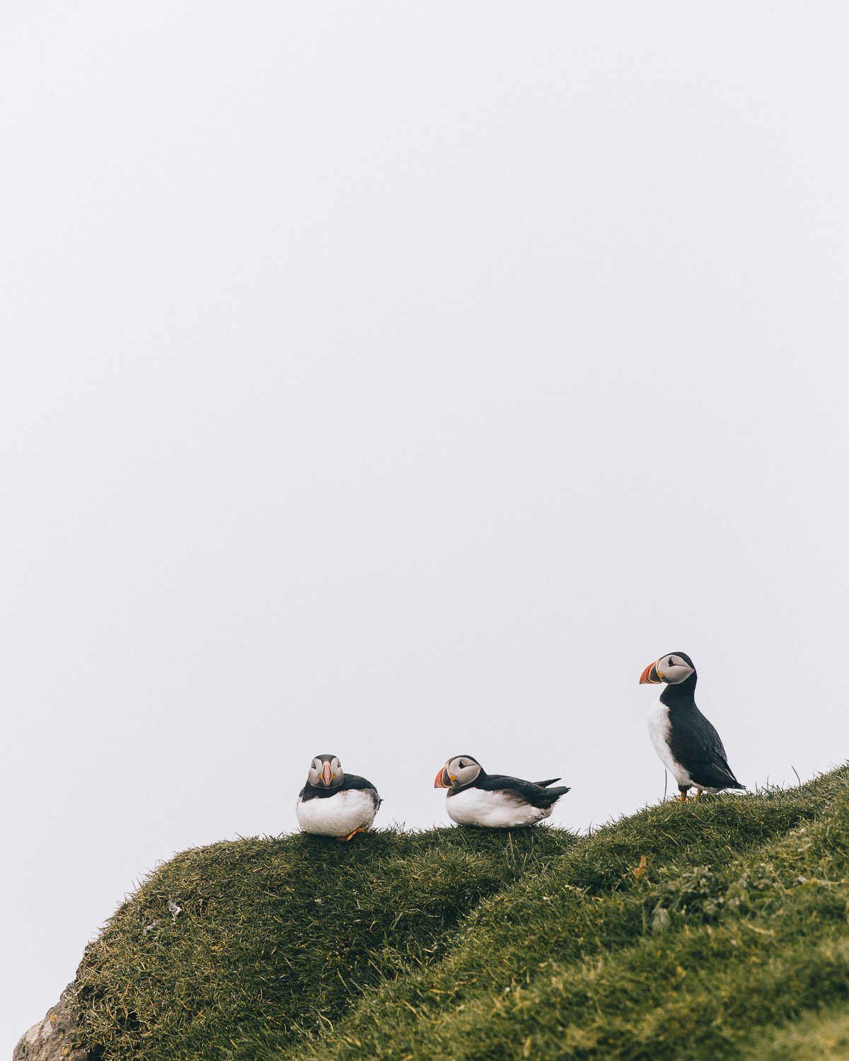
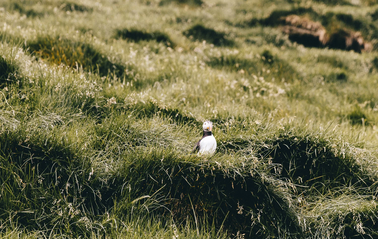
The Island of Mykines
Home to thousands of puffins, epic scenery, one of the most photogenic lighthouses in northern Europe, - plus a memorable journey by sea or air to reach it - it’s little wonder that a day trip to this tiny island is one of the most popular things to do on the Faroe Islands.
It’s important to note however, that due to their relative inaccessibility, the need to preserve the wildlife, and a small resident population, access is now tightly limited. Both transport and entry permits must be booked in advance, and even then, the weather may well decide otherwise, as we found out when cancelled ferries forced us to move our visit from Day Two to Day Seven.
There are two main ways to get to Mykines: by ferry or helicopter.
The ferry from Sørvágur (Route 36) departs at 10.20am and returns around 5pm, taking about 45 - 60 minutes each way. Tickets, including the mandatory 250 DKK environmental fee, must be booked online at mykines.fo well in advance, as only a limited number of passengers are allowed per day.
Alternatively, the Atlantic Airways helicopter connects Vágar Airport and Mykines a couple of times a week for 145 DKK one-way, though seats are limited and islanders get priority. Most visitors combine one leg by air and the other by ferry.
The hike to the Mykineshólmur lighthouse takes around three hours return, passing puffin burrows and dramatic sea cliffs. The path is open between 10.30am and 5pm under warden supervision, and drones are banned during nesting season. Afterwards, you can warm up with a hot drink in the little café by the harbour before sailing back.
Note that the if, like us, you are going to be travelling from Torshavn to Mykines, then it’s a 45-60 minute driver to the ferry terminal, so plan plenty of buffer time in case the weather or ferries don’t cooperate.
We’ve written a comprehensive guide to visiting Mykines, which we highly recommend checking out before planning your own trip to the Faroe Islands.
Where We Stayed | A second night in our ‘Hobbit House’ in Torshavn.
Driving Time | 2 hours

Day Eight | Explore & Depart
Depending on your flight time, your last day will really be nothing more than a ‘pick up day’; a chance to quickly visit any easily accessible sites that you missed during your first loop of the islands.
For us, we revisited a few spots to take some photos as the weather was improved from earlier on in the week, but if you fly in the afternoon or evening, it would be perfectly possible to squeeze in a short hike too!
Essentials You’ll Need Along The Way
| Good hiking shoes. Despite being on a road trip, any Faroe Islands road trip will involve a fair bit of hiking, the vast majority of which you should absolutely not attempt in a pair of trainers. Ideally hiking boots as opposed to hiking shoes as well (Andrew really missed the ankle support on this hike).
| Charged phone + Google Maps download. Phone reception is sketchy at best across the vast majority of the islands (3G/4G almost non-existent), so having an offline map of that particular day’s outside location is really important. You don’t want to end up off trail, completely lost and relying on a rescue helicopter to get back to your car!
Or, of course, you could go old-school with a physical map, if you’re that way inclined. Always pack a head torch for hikes in the Faroes too for safety.
| Layers. The weather in the Faroes is not ideal, even in summer, which means you’ll need plenty of layers to keep warm - and plenty of layers to take off as you get hot and sweaty on hikes. Think Merino wool base layers, fleeces and insulated jackets, plus beanies and even a pair of gloves!
| Waterproof Jacket. It rains an awful lot in the Faroes - those colourful waterproof jackets are not just for posing in photos, they are a must-have item for any hike here.
Hiking Poles | We did all our hikes without these, but if you have bad knees or would prefer a little support on the challenging ascents and descents which are very common on across a number of Faroese trails, then it’s sensible to bring a set. For our recent trip to South America, we bought these lightweight, collapsible set of travel hiking poles which were great.
| Snacks + Water. Never head out on a hike without some simple food supplies - especially in locations where amenities are few and far between. Oh, and be sure to stay hydrated with a full water bottle (refillable water bottles, of course).
| Leave no footprints - remember to respect the location, and discard of any litter appropriately.