Our Fishermen's Trail Itinerary & Planner
We’ve written this day-by-day itinerary for The Fishermen’s Trail in Portugal to help other hikers prepare for both the short and the full version of this fantastic multiday hike. The hope is that you’ll use it in two ways to help you prepare and travel better:
A general pre-trip planner to aid you in understanding the route, the conditions, the distances, the sights, and the accommodation options on each section.
A journal full of practical tips, personal insights, and useful resources so that when you’re actually on the trail you know where to find good coffee, unmissable stops, whether you should the set the alarm early or pack a lunch, the best footwear to choose for that daily section, and beach bars you’ll want to hike a little quicker to reach for sunset cocktails.


It’s basically what we wished we had before we set off to walk for thirteen days walking from Alentejo down to the Algarve. So, whether you’re doing the classic four or five-day version of the Fishermen’s Trail from Porto Covo to Odeceixe, or continuing all the way down to Lagos, you’ll be ahead of the game!
This is our day-by-day Fishermen’s Trail itinerary and planner!
Pssst! Only started your research into this long-distance walk? In our main guide, we’ve shared all the Fishermen’s Trail essentials.

The Fishermen’s Trail Route & Sections
One excellent aspect of this particular 226.5km walk is that someone else has done much of the hard work already.
The route and daily start/end points are well-established and sensible, meaning there’s no need to deviate or diverge too much from it and you don’t have to waste hours piecing together your own bespoke route.
The official Fishermen’s Trail itinerary, split into daily sections ranging from 10 km to 22.5 km a day, is outlined below with their estimated times:
| Day | Start | End | Distance (km) |
|---|---|---|---|
| 1 | São Torpes | Porto Covo | 10 |
| 2 | Porto Covo | Vila Nova de Milfontes | 20 |
| 3 | Vila Nova Milfontes | Almograve | 15.5 |
| 4 | Almograve | Zambujeira do Mar | 22 |
| 5 | Zambujeira do Mar | Odeceixe | 18.5 |
| 6 | Odeceixe | Aljezur | 22.5 |
| 7 | Aljezur | Arrifana | 17.5 |
| 8 | Arrifana | Carrapateira | 20 |
| 9 | Carrapateira | Vila do Bispo | 16 |
| 10 | Vila do Bispo | Sagres | 20.5 |
| 11 | Sagres | Salema | 19.5 |
| 12 | Salema | Luz | 12 |
| 13 | Luz | Lagos | 11 |
The three main pre-trip decisions we made after a lot of research were:
Starting in Porto Covo, rather than São Torpes (good choice)
Our rest day would be in Sagres (big mistake)
We wouldn’t combine the final two sections from Salema - Lagos (no biggy)


A few quick points on how we’ve laid out our own itinerary and day-by-day planner:
· As we’ve mentioned in our main Fishermen’s Trail guide, this is not a hardcore hike and should be manageable for most travellers who have a decent level of fitness and can comfortably walk for 6-8 hours with a backpack. Difficulty is always going to be subjective, but we’ve let you know whether to expect an ‘easy’, ‘medium’, ‘tough’, or a ‘good God please make it stop’ challenge for each daily section.
· The goal is to help you prepare and give you a flavour of the Fishermen’s Trail, rather than lots of spoilers. So, for each day, we’ve shared our main highlight (the ‘rose’) and hardest or worst bit (the ‘thorn’) to give you a heads up on what to look forward to, and what you need to be ready for.
· If you’re doing the 4-5 day Classic Fishermen’s Trail, then you only need to read to the end of ‘Day Four | Zambujeira do Mar - Odeceixe’
· Due to diversions, unexpected route changes, and common underestimates / errors in the official guidebook, there were several sections where we ended up walking quite a bit more than expected! We’ve included both the kilometres and times we logged, as well as what the official guide says.
· We’ve included brief trail and terrain descriptions to help you plan, as well as the all important footwear recommendation for each day! If you’re not sure whether you’ll need to put your hiking sandals on, wear your gaiters, or it’s a day for the big boots, this’ll help you out a lot.
· There’s hand-picked accommodation options for every travel style and budget, including where we stayed and where we would have liked to stay. As every hiker is going to be based in the same start/end towns and villages, it’s a good idea to get these booked in advance.
· If you want to know exactly what we packed and carried, read our Fishermen’s Trail packing list post
· If you’d like to watch our daily Stories from the hike, you can find them here on Instagram

The Fishermen’s Trail Day by Day Itinerary
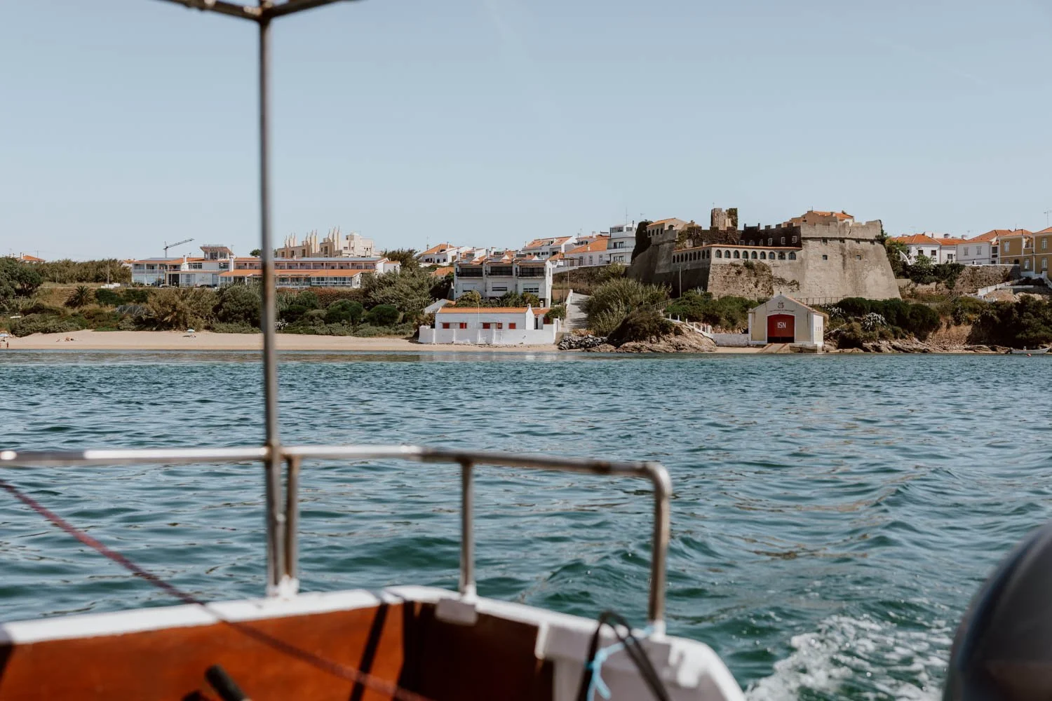
Day Zero | Lisbon to Porto Covo
We flew into Lisbon on an early morning flight from the UK, then took the bus down to Alentejo.
That region doesn’t have an airport or good train coverage, so most hikers also take that bus from the capital.
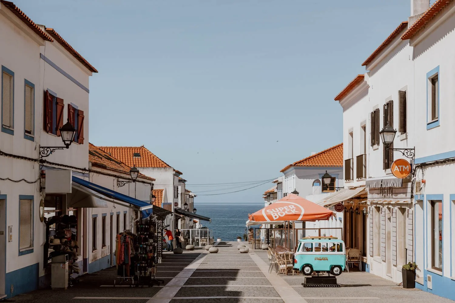
The pretty little beach town of Porto Covo is the original start point for the Fishermen’s Trail, and we highly recommend beginning your hike there instead of São Torpes, 10km further north. Most hikers do the same as it isn’t an attractive walk nor any easier logistically, and this decision will instantly save you a day in your itinerary as well as the cost of an extra night’s accommodation.
From Lisbon to Porto Covo, the bus takes 2-3 hours, and the only bus company running the route is Rede Expressos.
They have several daily departures from Lisbon’s Sete Rios bus terminal (Google Maps), as well as Lisboa Oriente station on the other side of the city (closer to the airport).


Know / Book your bus ticket online in advance as seats do sell out
Eat / There’s a small but well-stocked mini-market in Porto Covo to buy your snacks and packed lunch for the next day, as well as several restaurants along Rua Vasco da Gama.
Tip / The book shop near the top of Rua Vasco da Gama sells the official Rota Vicentina guidebook and maps, whilst these are also available to buy at the tourist information office on Rua do Mar, near start of trailhead in Porto Covo (here on Google Maps) .
The guidebook is expensive at €15, but it supports the maintenance of the trails and is a useful, detailed reference for anyone doing the full Fishermen’s Trail or wishing to include any other Rota Vicentina walks.
Stay / There are lots of options in Porto Covo, but last minute booking meant that we ended up where they had availability - Hotel Apartamento Porto Covo. It was actually a pretty decent place to stay, but two really lovely options are O Lugar and Ocean House Alentejo.
There are also a number of excellent accommodations available on Airbnb including this beautifully restored beach cabin, Doorless House, Casinha da Baía and Wonderful Views Apartment.
Note that given that Porto Covo is a hoiday destination in its own right, accommodation here is more expensive than elsewhere in Alentejo, especially if hiking the trail in late spring or late summer.
Plan / Read our short guide ‘How to Get from Lisbon to Porto Covo’.
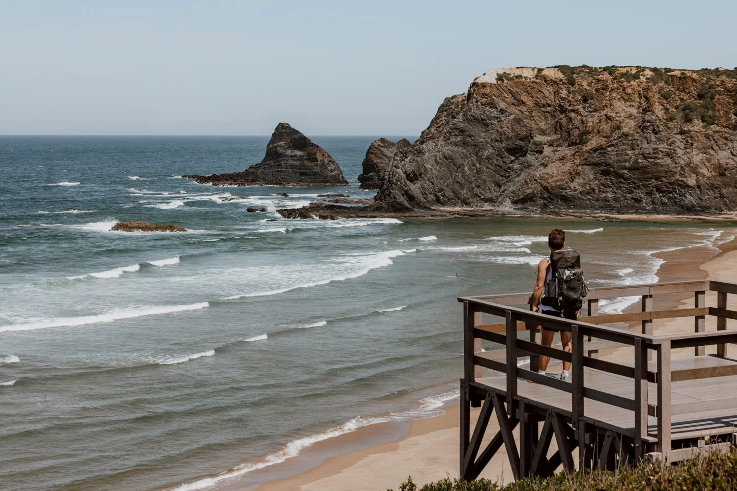
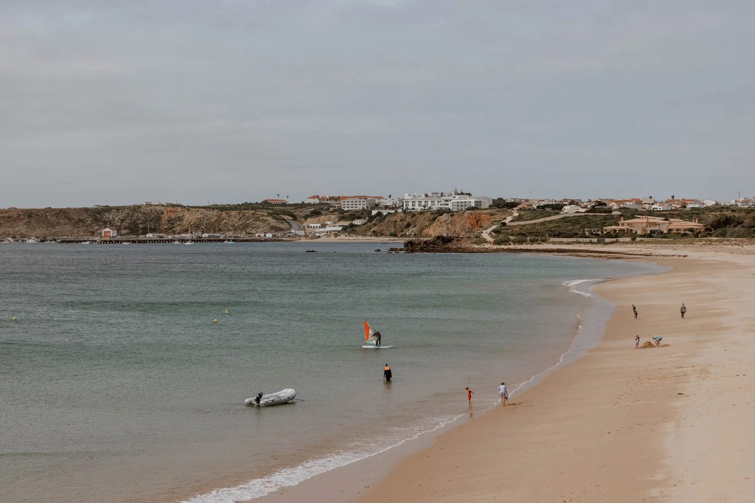
Day One | Porto Covo - Vila Nova de Milfontes | 20km
Your first day starts with a very decent amount to cover, but it’s also one of the most beautiful sections of the whole Fishermen’s Trail.
For those doing the shorter Classic version from Porto Covo to Odeceixe, this is going to be one of your most challenging days due to the dunes and distance.
It’s nothing to fear though, and will actually serve as a very good indicator of whether you’re going to be able to enjoyably complete or manage the 4/5 or 11-13 day route.
As it’s such a wonderful introduction to the Fishermen’s Trail and Vicentina coast - with wildflowers and waves, secret beaches, surfers and secluded coves - we recommend not rushing it.
Distance / We walked 22km door-to-door vs. the official route’s 20km
Start + End / 7 hours vs. official route’s 8-hour suggestion. We began at 11.25am this day, and it was very much a rookie error.
Challenge / Medium but very manageable


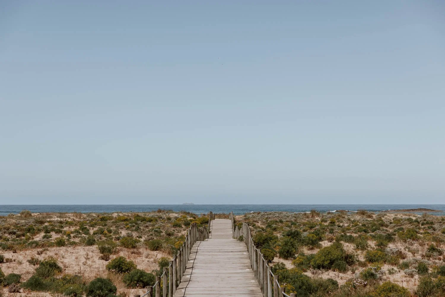
Trail / The vast majority of the route - about 15-17km - is along sandy paths and the dreaded dunes. The rest is compact ground, with a few beaches and portions of rocky terrain. Most is along the coast, but about 5km is officially diverted slightly off of it in order to preserve dunes and prevent cliff erosion.
Note that, in order to see or stop at some of the beaches, you’ll have to go slightly off the main path.
Footwear / Due to the dunes, this is the day for your hiking sandals (which we found perfect for this section) or wearing those sexy gaiters over your hiking boots. If opting for any other type of footwear, you will have to stop every so often to empty out the sand.
Rose / The excitement of finally being on the trail, and the last section of the walk before the road to Vila Nova de Milfontes
Thorn / The sandy terrain is most common on this section and, though not as bad as we expected, it does take its toll. However, that’s mainly because they make the long distance feel longer and more tiring, rather than presenting an immediate physical or walking challenge - but some may struggle with it more than us.
Eat / There are only spots with food available toward the start and end of the trail today so bring enough snacks and a packed lunch. As it's your first day on the hike, a bigger breakfast and plenty of water is a good idea before you set off to gauge your energy + tiredness levels.
You’ll need to carry at least two litres each today.
The beach cafe of Forte de Nossa Senhora da Queimada is only a few kms after Porto Covo, so won’t be an essential stop for many, but you should try to include the much recommended bar/restaurant Porto das Barcas (maps). As it’s just 3.5km from your final stop in Villanova though, some of you may prefer to hold on.
In pretty Vilanova de Milfontes, you'll find several restaurants and bars along Largo do Rossio (maps), and we LOVED our tuna steaks and the playlist at Bar Cá P'Ramim (maps)
Tip / If you are running late or struggling, you can choose to end your walk at Porto das Barcas, then order an Uber/Bolt for the last stretch - there were signs up in the right spot advertising this.
Stay / We stayed at Sol da Vila in Vila Nova de Milfontes and would highly recommend it.
A couple of alternative guesthouses if the above is fully booked are Villa Eira, Casa Do Adro Da Igreja Turismo De Habitação and Charm-In Center. Apartamentos Dunamar is nothing fancy, but very well set-up and popular with hikers.
See more options in Vilanova de Milfontes here on Airbnb.


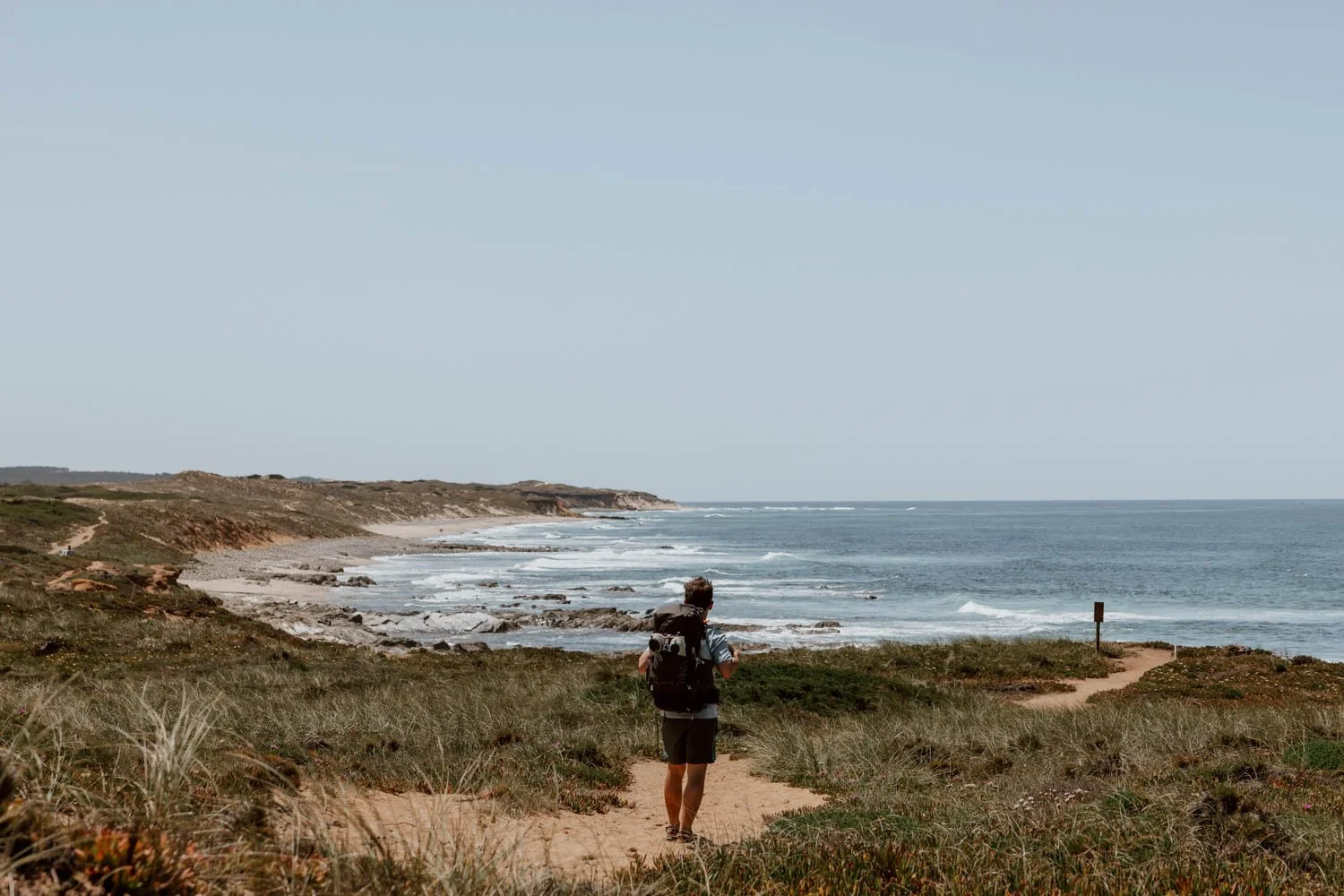
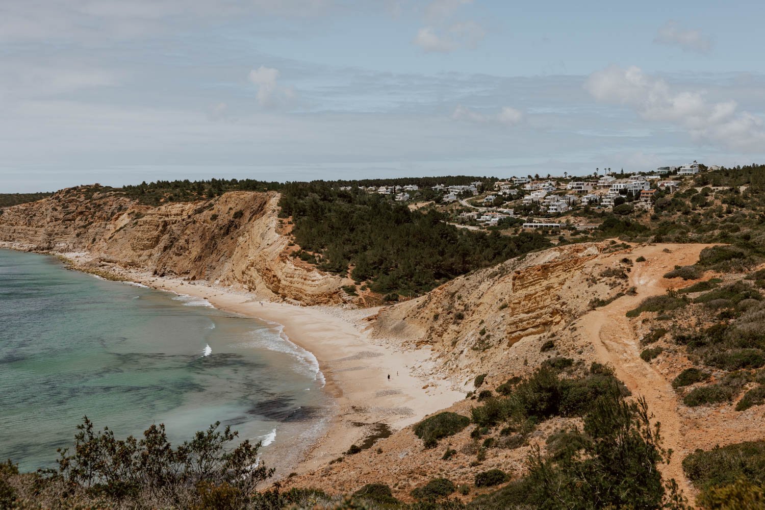
Day Two | Vila Nova de Milfontes - Almograve | 15.5km
A much shorter and easier day, which felt more like an ‘experience’ to savour than an endurance exercise.
There’s the option of a photogenic boat crossing shortcut (which we recommend), a variety of excellent beaches and coastal views to enjoy along the way, and enough time for even the slowest of hikers to amble along the wonderfully protected and undeveloped pristine Vicentina Coast without a worry.
However, due to the shorter distance, its crossover with a popular Circular Trail route, and the quality of the hidden away beaches, this is one of the days where the trail feels quite a bit busier.
Distance / We walked 14km with the boat shortcut vs. the official route’s 15.5km
Start + End / 4 hours vs. the official 5.5 hours
Challenge / Easy
Trail / Some wooden boardwalks and lots of compact countryside trails through fields and by the coast. Several narrow and overgrown sections through the acacia bushes and trees, with some not offering enough room for people to use the path both ways. There’s also an uphill section which is more of a dune and steeper than anything we did on Day One!
Footwear / Sandals are a good option due to the number of unexpected dunes along the way, but boots and gaiters would also work.
Rose / The boat ride (see below) and Praia do Brejo Largo. It’s a stellar beach - typical of those you'll encounter along the Fishermen’s Trail - but only has your fellow hikers and those in the know. Make sure to walk down to it, as well as enjoy the views from above - find it here on Google Maps.
Thorn / No major issues or frustrations today, except being twatted in the face a few times by acacia bushes and a teeny tiny bit of congestion in parts.
Eat / If you have a decent breakfast in Vilanova de Milfontes, you may not need anything until you reach Almograve. We recommend making time for excellent specialty coffee and pastries at Laréu Cafetaria (maps), who also offer larger breakfast plates.
Across the water from Vila Nova de Milfontes, the beachfront Oasis has coffees in the morning and is a nice spot with a view, but there’s very little else available as it's more of a lunch place. They can sometimes make up sandwiches to take away, but we wouldn't 100% rely on availability in the morning.
There are no restaurants on today’s stretch so it’s definitely a good idea to bring snacks or a packed lunch if you’d prefer to have a scenic picnic stop along the way!
Make sure to arrive in time for sunset drinks at Bar da Praia do Almograve (maps). This is a super cool modern beach bar with excellent cocktails as well as small plates, and the ideal set-up for post-hike drinks overlooking the beach. This is a popular place with young locals, so it’s definitely worth changing out of your sweaty hiking stuff and cleaning up!


Tip / We highly recommend starting today’s section by taking the shortcut with the Maresia do Mira ferry across the calm estuary to Furnas beach.
We thought it would be cheating, but the receptionist at Sol da Vila insisted it was a worthwhile way to save walking two to three kilometres along the roadside and across a bridge to reach the exact same point.
She was totally right - and a fellow hiker who went via the road + bridge said we missed absolutely nothing except a pleasant view; she wished she’d taken the boat instead.
The service starts at about 8am in the spring months (9am in winter), the crossing takes five minutes, and you buy the €5 ticket at the small kiosk by the water with many cats (cash only) - find the departure point here on Google Maps.
If you wish to clarify services or departure times, contact them on 964 200 944 or via Instagram @maresiadomira. Donations also welcomed before you cross for the cat charity 'Os Gatos do Mira'!
Stay / We stayed at the HI Almograve, which was a very very popular choice with fellow Fishermen’s Trail hikers and has lovely reception staff. However, the check-in is not until 6pm, which is pretty ridiculous, so we suggest lingering a little longer in Vilanova that morning if you’re staying there.
Alternatives that are equally well set-up for hikers include Casa Isa, Fishermans House, Vicentina Rooms and AL Casa das Andorinhas.
Airbnb also has a number of great options including Nature House, Almograve Getaway, Casa Azul, Hikers House, and Beach House.
Day Three | Almograve - Zambujeira do Mar | 22km
This is one of the longest days of the Rota Vicentina, and the longest distance you’ll cover on the Classic Fishermen’s Trail.
There aren’t as many beaches to admire or visit along the way, with the scenery being more dramatic cliffs, craggy coast, and crashing waves. We had poor, overcast weather for much of it, which made it all feel very wild Atlantic, and a bit more reminiscent of hiking in Ireland or Scotland than springtime in Portugal!
There are a few more ups and downs than previous days, and much more walking on sand and along roads than we anticipated. However, the storks, a fish restaurant, the scenery, the arrival into Zambujeira do Mar - plus the feeling of satisfaction once you’ve completed a very decent distance - combine to make it a good day.
We recommend an early start today.
Distance / The official route says 22km, but we did 24.6km due to a missed turn and our final accommodation being a bit out of town.
Start + End / 8 hours vs. official 7 hours
Challenge / Medium due to length, time, and a few steep upand downs toward the end.
We were both quite exhausted by the time we made it to Zambujeira do Mar - more due to the cumulative impact of three days walking rather than this specific section’s challenges - and definitely needed this evening’s sweets and pasta binge!


Trail / A lot more sandy terrain and dunes than we expected, particularly on the first section of today. Frustratingly, the guidebook hardly mentioned this, but there were plenty!
The trail also has many more ups and downs than previous days, with the craggy coastlines and wild Atlantic look and weather pairing together quite well.
Footwear / We opted for our running trainers, which was the wrong decision given the amount of sand on various sections. Boots with gaiters will be best.
Rose / The stork’s nests, which you'll find primarily on the stretch of clifftop boardwalks and trails after the cafe in Cavaleiro and in front of the Wes Anderson-ish Farol Cabo Sardão lighthouse (maps). This is apparently the only place in the world you can actually see them!
We liked picking up the pace on the flat, and Emily’s delirious dancing overlooking the beautiful Praia de Nossa Senhora near the end of the day (maps)
Thorn / The unexpected dunes. Some will not enjoy the fact that, after the lighthouse, it’s all compact standard trail then road for a big chunk of the way; but it does finish with a nice bit of coastal walking!
Eat / Breakfast was included at the youth hostel, so we unfortunately don’t have a personal recommendation for Almograve - let us know in the comments if you do!
There’s no need to bring a packed lunch today as there’s a great restaurant along the way, but snacks are a very good idea. The bustling little Adélia cafe in Cavaleiro (maps) is 9.5km along the trail, and the first stop on today’s route for coffees, drinks, pastries, or simple lunches and sandwiches. Popular with local farmers and old boys, it’s very Portuguese and very Alentejo.
The other option in town is Restaurante Rocamar, but it was closed on the day we passed through.
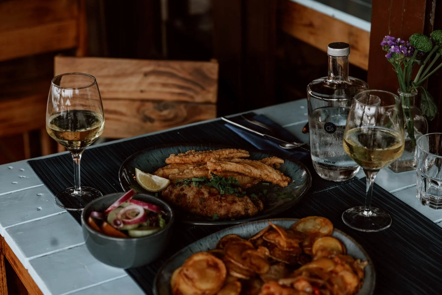
If you love seafood and fish, then you should hold off on the sandwiches to ensure sure you're hungry enough for the highly-regarded O Sacas restaurant (maps). Family-run and just recently celebrating its 40th anniversary, you’ll find it after the descent down to the harbour and then the cruel little hill. It’s very popular with locals, especially on the weekends, so it's not a bad idea to set off a little earlier in the morning or even book a table if you plan on eating there but your walk coincides with peak weekend lunchtime.
You can also just stop for a well-earned beer or glass of wine - closed Wednesdays.
Tip / We followed the official route start from Almograve, which took us via a pretty church, a sewage plant, and then a short climb up from a beach. Instead, you should just go straight toward Praia do Almograve along the road from town, as it will give you an extra half hour in bed and save some energy for the trail.
Stay / Our choice of Camping Villa Park in Zambujeira do Mar was based on very limited availability. A holiday camp of sorts, it has a surprisingly good shop, but was situated a frustrating 10-minute walk out of town. Better options near the end/start point are: AZUL, Rosa dos Ventos, Ondazul, Hakuna Matata Hostel and Hostel Nature.


Day Four | Zambujeira do Mar - Odeceixe | 18.5km
For many, this will be the final day on the Fishermen’s Trail - and you’ll more than deserve a few cold beers at the finish.
Alongside Day One, this was the most scenic stretch for us, with dramatic clifftop views and an abundance of wildflowers.
It also felt the most like a proper ‘hike’ rather than a coastal walk, with a more varied route profile and plenty of short, steep climbs and descents over rocky, uneven ground.
If you’re someone who enjoys a physical challenge as much as a photogenic view, this will likely be your favourite day of the Classic Fishermen’s.
Distance / The official route says 18.5km, but we actually walked 24.4km due to a signposted re-route / diversion that varied from both the guidebook and our AllTrails offline map.
Start + End / 7 hours 20 minutes vs. official 7 hours
Challenge / Medium for us but some may rate it as ‘difficult to very difficult’ due to the up/downs and terrain.

Trail / More varied than previous days, with a number of steep, uneven parts and loose rock up-downs. There is increased potential for a slip or going over your ankle, so stay focussed!
There were also more sandy sections and dunes than we expected (as many as Day One), and a teeny bit of scrambling required after the boat harbour. There were parts through pine forests and some road walking too, but these sections when you’re away from the coast are as good as when you’re on it.
Keep an aye out for the new blue and green markers, as online apps and the official book didn’t reflect the changes at a couple of key points.
Footwear / We switched between our hiking sandals and trainers, but boots with gators will be best given the amount of sandy sections and requirement for decent grip and stability in areas.
Rose / The variety and challenge of the route and terrain, the stunning Praia dos Machados (maps), and bizarre sight of zebras and ostriches at Agrobrejão (maps), supposedly the brainchild of a wealthy local to create a safari park in the future.
Thorn / Emily really struggled for the last 4km, and we were a bit pissed off at the difference between the expected distance and the reality. For some, the up/downs and slippy terrain will be a bit more of a struggle given fatigue levels.


Eat / Today is definitely a 'food as fuel' day, rather than it being about eating for enjoyment or experience. Therefore, even if you plan on having a nice seafood lunch at one of our recommendations, you also need to bring plenty snacks - that Clif bar when Emily hit a wall was probably the most important thing we packed!
You also need to carry extra water.
A Azenha do Mar (maps) is a nice little cafe and seafood restaurant in a very quite Portuguese coastal town about two-thirds along the trail - we only had a couple of espressos, there but lots of other hikers sat for a proper lunch with a sea view. Closed Wednesdays.
An alternative in the same town is Café Palhinhas (maps)
There are no other food or drink options along the way until Odeceixe, so you must bring a good packed lunch if not dining at the above.
In Odeceixe, Ao Largo (maps) is a good shout for a celebratory cocktail whilst, for the evening, there’s half decent pizza available at Pizzeria Dal Monello and several good local fish restaurants to choose from.
Tip / When you approach an excellent final viewpoint over Praia de Odeceixe and Ribeira de Seixe (about here on Google Maps), you’ll then walk through the forest before descending down to the beach and road. From that point, it’s another 4km walking along a tarmac road into the town of Odeceixe - this is the section which broke Emily, where only a forced down chocolate chip Clif bar, stubbornness, and fury at Andrew’s intended encouraging words gave her the energy to finish.
The road walk is perfectly fine and doable (just watch for the blind corners), but definitely missable if you’re utterly exhausted. Completionists on the four-day Classic route should probably insist on walking it for that ‘final leg’ feeling to end the Fishermen’s Trail on your own two feet, but we saw several people opt for a taxi.
Just in case, here’s a local taxi number our hotel supplied: Silvia Novaies +351 939 780 396 / +351 937 333 273.
Note that, as Odeceixe town is quite a bit away from Praia de Odeceixe, so if you want to enjoy some time on that beach, doing it at this stage of your walk is the only likely opportunity.
Stay / A cheap and cheerful hotel with lots of rooms, despite initial appearances, Residencia do Parque was actually a pretty good place for the night.
If there had been availability, Bohemian Antique Guesthouse would probably have been our first pick but other decent options for a night include SulSeixe Guesthouse, Sudoeste Guest House and Sol Mar. If you’re sticking around for another night or two, check out AL-Odeceixe Verde.

Other Articles in the Rota Vicentina Series
How To Get From Lisbon To Porto Covo
The Fishermen's Trail In Portugal | The Essential Guide
The Fishermen’s Trail Packing List
The Rota Vicentina | An Essential Guide


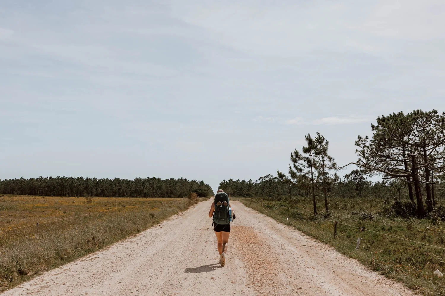
Day Five | Odeceixe to Aljezur | 22km
There was a lot of inland walking today, offering an indication why Odeceixe marks the end of the most popular short version of the Fishermen’s Trail.
The number of hikers sharing the trail notably thinned out, and many familiar faces from the previous days obviously didn’t continue on.
This section ended up being our longest single day distance on the trail, and we both took the opportunity to put the headphones in and enjoy the firm ground, trying to keep to a reasonable pace throughout.
This was a day about getting it done.
Distance / The official estimate is 22.5km, but we did 25.6km
Start + End / 6 hours 30 minutes vs. the official 7 hours
Challenge / Easy walking but a long, tiring day. Six new blisters too!
Trail / There’s a teeny bit of sand, but it’s mostly dusty flat trail and quiet countryside tarmac roads, popular with cyclists. There’s also a portion of forest trail.
The are several sections that intersect with the Historical Way (red and white markers), and you’re actually following it from Roil to Aljezur. Due to this, and a few other turns where you can easily go wrong or end up on a different trail, this is one of the first days where we recommend having a map app available (we used AllTrails) and paying a bit more attention to the markers.
Footwear / Trainers for us - you definitely don't need sandals or gators for the vast majority of this section.

Rose / Unlike others we met and most of the comments on AllTrails, we actually enjoyed the change of scenery from the coast, and it made us appreciate it all the more when we returned to it. Passing various farmers, baby brown cows, and a myriad of bucolic moments - and guzzling several canecas with locals at the end.
Thorn / The longer than expected mileage really took its toll for the last hour, especially when we realised our accommodation was situated another 10 minutes or so from the end of the trail in Aljezur.
For some of you though, today’s ‘thorn’ may be the monotony of the back country roads (especially after the Sweet Potato Museum) and lack of ‘scenery’.
Eat / Odeceixe is a nice little town, and we had high expectations for the breakfast at Ao Largo (unfortunately it didn’t meet them).
There are a few other simple options in Odeceixe - like Retiro do Adelino - or you should hold on for your morning coffee until you arrive at the two beach cafes about 3km into the trail (Esplanada do Mar is in a great spot if the wind isn’t too strong).
After that, there’s nothing available until the town of Rogil (over halfway to Aljezur). Rather annoyingly the official book didn’t mention that this town exists, so perhaps the town doesn’t pay its dues or there was a falling out. Most of you will be very glad of the opportunity to stop for a vinho verde and a bathroom break at Restaurante Museu da Batata Doce (maps), which is a popular restaurant with lots of interesting cheese and meats plus a big outdoor garden. There’s also a supermarket near the petrol station if you just want to pick up something quickly.


It’s a whole lot of nothing before and after this, so this is a day where you need to bring enough snacks and have plenty of water with you throughout, and know that it may be preferable to have a packed lunch.
A highlight of the day was the stop at the trail end, when we were both absolutely pooped, for several canecas at A Tasquinha dos Borralhos (maps). A little place beside the Mercado Municipal, the owner is a character, and it’s a good place to try your first snails in Portugal (a very common snack in these parts that you’ll also see throughout the Fishermen’s Trail).
We were shattered so preferred to get double veggie burger stuff from the huge Intermarché supermarket in the new part of town, so unfortunately we don’t have a personal recommendation for the evening in Aljezur. However, a follower did recommend pizza at Arte Bianca (maps) - let us know if you have a favourite to suggest!
Tip / Make sure to follow the newly marked route, and take advantage of the old bus shelter when you see it for some pit stop shade and snacks. Also, a mentality shift is required to appreciate how rural and beautiful the countryside is, rather than disappointment at not being on the coast.
You’ll also pass this dog & cat shelter toward the end.
Stay / Inland Aljezur is split by a river, so you'll either stay in the old town or over on the other side of the bridge. As you’ll arrive in the old town first, and that’s where the daily section officially ends, it makes sense to stay there - Amazigh Hostel & Suites, Guesthouse Aljezur Center and Calma Aljezur are all excellent options.
There are also an abundance of really lovely Airbnbs (both apartments and small houses) in this part of town. If you’re looking for your own space, be sure to take a look at Hillside 2, Casa Xodó, The Blue Door, Casa Jasmim, Casa Branca, Cosy House, and Renovated Apt.
The ‘new town’ on the other side of the bridge is perfectly nice though, with more accommodation options and the massive supermarket if you want to treat yourself to a carb-loading binge and toiletries top-up; the extra 5-10 minutes walking over there however is not so welcome after a very long day on the trail!
Casa Rocha Relax was the only place with availability when we were looking, but the ‘hiker house’ set-up was absolutely perfect and the host super friendly. The facilities meant we could do a much-needed round of laundry in the washing machine, cook dinner, plus have a nice, slow breakfast in the morning.
Travel Tip // Strategically booking an Airbnb with a washing machine around this stage and later in the full Fishermen’s Trail is a really good idea. As well as the clean clothes, the opportunity to clear out and repack your bag is revitalising.
Day Six | Aljezur to Arrifana | 17.5km
Two Belgians and a German hiker staying at Casa Rocha Relax were using the Cicerone Fisherman’s Trail Guidebook, rather than the official Rota Vicentina book we had picked up in Porto Covo.
Ours said today’s section was a 17.5km walk, whilst theirs said we should pretty much be following the Historical Way for a total of 12km.
The former stayed largely along the coast, the latter was exclusively inland - both ended in Arrifana.
Our bodies were screaming for a rest day at this stage, so chopping off 5km and gaining more tactical time poolside in Arrifana won out.
The trade-off? We missed Praia Monte Clérigo and the coast today.
This was the only day we deviated from the official itinerary, but the Belgians and the German insisted we were still doing the Fishermen’s Trail - apparently it’s the new version which changed the route!
The choice today is therefore up to you and your body - whichever you pick, you’ll end up in the same place.
Distance / 12km for us, but 17.5km if you stick to the official coastal route
Start + End / 3.5 hours for us, but the official book suggests 6 hours
Challenge / Medium due to two or three steep climbs and a lack of shade throughout. For the Fishermen’s Trail section, the official book describes it as ‘average’.


Trail / The Historical Way and Fishermen’s Trail share the same trail for the first 2.5 km - involving a steep up and up - before the former splits off across the road and the latter continues toward the coast. Both are clearly signposted at this split, but double-check to make sure you’re on the right path.
If you’re following the Historical all the way, be sure to grab shade whenever you can if it’s a hot day. It’s mostly dusty backroads, with a bit of main road walking on the way into Arrifana.
Footwear / Trainers or boots, but we did it in hiking sandals.
Rose / Our energy levels were so low today that being able to cut off 5km and more time sunbathing by the pool at The Lighthouse Hostel was the undoubted highlight.
Thorn / The hills and the heat, with the trail today actually being quite dull.

Eat / We made our own breakfast at Casa Rocha Relax, but you should consider the following in Aljezur: Koyo Speciality Coffees (maps) and Moagem Cafe (maps)
There were no places to stop for food or snacks on the Historical Way, but you will find options at Monte Clérigo beach if taking the Fishermen’s Trail.
In Arrifana, we devoured the veggie burgers at HOKAPIA (inside the HI Arrifana Destination Hostel), and then scrubbed up and treated ourselves to a really fantastic, fancier evening meal at the highly-recommended Cal Arrifana (maps).
Tip / If you’re lacking energy for this section, but want to stick to the new official Fishermen’s Trail route, consider taking a taxi from Aljezur to Espartal or further down to Monte Clerigo. Yes it’s technically cheating, but the first 2.5 km out of Aljezur are unremarkable, with a fair stretch alongside a main road until you hit the coast at Espartal. The taxi will allow you to cut off 6-8km.
Also, do try to pop up to the Castle of Aljezur before you leave town.
Stay / The Lighthouse Hostel was absolutely worth the splurge. Arrifana is a cool little surf town - somewhere we’d happily be based for a few days - with lots of surf houses, camps, and hostels to choose from. Just bear in mind that it’s got quite a spread out layout, with some accommodation more isolated than others and requiring a walk to + from the beach, restaurants, or shops.


Day Seven | Arrifana to Carrapateira | 21.5km
We craved a rest day in Arrifana, and our biggest mistake was not realising how exhausted we’d both feel at this stage of the hike.
This would have been the perfect placed to have a lazy day eating and letting our bodies recover.
Instead, we had to hike another three bloody days to Sagres!
As mentioned in our main Fishermen’s Trail guide, not everybody doing the full thing takes a rest day but we think it’s absolutely essential (some people even take a couple).
Today’s section contrasted sharply with the glorious landscapes and bright colour palette we’d experienced thus far, with the grey shingle, dark inky waters, sea stacks, and flint-coloured cliffs on the first half certainly more North Atlantic in appearance.
After that, you’ll leave the coast behind for much of this section’s kilometres, before a welcome return to the typical southern Portugal scenes as you approach the beautiful Praia da Bordeira toward the end.
Distance / The official estimate is 20km or 21.5km as they have two options based on whether you can cross the Bordeira stream or not - we did 22km!
Start + End / 6.5 hours vs. the official estimate of 6.5 - 7.5 hours.
Challenge / Medium. As we were crying out for a day off by this point, today’s section was more about the mental challenge and simply putting one foot in front of the other. The hill climb at the 4km mark is quite a tough shift, but the rest of the trail is pretty much straight forward. However, it’s a long walking day, with blisters and fatigue playing their part by the end. Go easy on yourself.

Trail / Mostly flat dirt and gravel roads, but there are some cruel deep, hot sand dunes in the middle and alongside the ‘river’ at the end, just after the beach on the way into town. Note that there can be vehicles on sections today, so stick to walking on the left hand side and listen out.
We walked along Bordeira beach, but the guidebook mentions that it’s sometimes not possible due to the stream. If you’re stuck, take the alternative way into Carrapateira via the pine forest.
Footwear / We wore our sandals today, and they were ideal.
Rose / Emerging back out on to those wonderful coastal views after a few days going without them on the trails. There was also a gorgeous section through wheat fields (steady on Theresa May).
Thorn / Our blisters were starting to have a really negative impact, and this wasn’t helped by today’s unexpected dune sections. Overall, the route felt slightly duller - and some will hate the hill near the beginning and near the end.


Eat / We decided on an early start, and unfortunately didn’t pass anywhere on the way out of Arrifana from Lighthouse Hostel, but there are various options in town; just note that the layout is quite spread, so you may have to add 10-15 minutes on if you’re going into town before you start the trail.
There’s just one small café on the trail, around 8km in (about two hours from Arrifana). When we arrived, a group of walkers had been waiting 20-30 minutes for it to open, so early arrivals might be out of luck. If the roadside sign is out, it’s worth hanging on, but note it’s a simple menu of drinks, sandwiches, salads, omelettes, and cakes.
Either way, it’s a very good idea to bring a few snacks along today and a packed lunch to enjoy somewhere by the sea.
In pretty little Carrapateira, there are only a few options for drinking and eating out. Microbar is the most popular place in the centre (long waits or reservations may be required), but we opted for the atmosphere, decor, and dogs at Clube Cultural e Recreativo Os Amigos da Carrapateira (maps). It was ideal for beers and peanuts after the walk, and coffees with pasteis da nata for breakfast. Alecrim is another option to check out.
We cooked dinner at our accommodation in the evening, with the little but well-stocked Minimercado Irene (maps) being the only option we could find.
Tip / Praia da Bordeira is gorgeous but a 20+ minute walk from Carrapateira, so you are unlikely to make it back there if you’re tired after reaching town. Therefore, take the opportunity to take the backpack off and enjoy it before you continue!
Stay / Our first choice - Hostel do Mar - was fully booked, but the last-minute alternative of Casa Luminosa was much better than we expected. The big comfy bed, washing machine, sun-drenched laundry line, hot shower, and excellent kitchen were exactly what we needed.

Day Eight | Carrapateira to Vila do Bispo | 16km
With a lie-in, lots of coffee, and several pastel de nata, our enthusiasm levels were way back up at the start of today, and we were both exhilarated at points of this section - possibly through delirium or exhaustion, or because we had the tantalising prospect of a rest day coming up.
Compared to the rest of the Fishermen’s Trail, there are quite a lot of steep, long up-downs. These are concentrated in the first half of the hike, as you trace some excellent coastal scenery.
It’s balanced out by the final 7km being along a flat, dusty road without much to keep you entertained (definitely a time to put the headphones in and playlist on).
Distance / 16km official, but we did 17km
Start + End / 5.5 hours vs. the official estimate of 6.5 hours
Challenge / Medium for us, but the guidebook lists it as a hard day. Some walkers will really not enjoy the frequency and steepness of climbs in the first half of the hike, especially on already tired legs, and you need to factor that into your timings. However, that’s also the most enjoyable part of today’s trail, so try to keep to a slow, sensible pace and enjoy the breaks overlooking the beach and waves.


Trail / It’s road and dusty track to Praia do Amado, which is popular with surfers. Go along the sand and the trail continues on the left, with quite a significant hill ascent. There’s another of these, then a lovely little secluded beach, and then it’s an up up up along a track and road. You’ll trace the cliffs on a dusty road to lead you back to the sea, before descending to some Scottish-looking black rock beaches, then a final significant ascent. After this, it’s flat all the way (with the last big hill at the side of a relatively busy, fast-moving road).
There are various points where it would be easy to take the wrong turn on to different route, and at points on the last half, the blue and green signs for the Fishermen’s Trail simply stop when you merge with the Historical Way, so you’re actually following the red and white markers. Pay attention when you hit the crossroads where several trails intersect!
Footwear / Sandals today were excellent in parts, but two new blisters hinted at things to come…Given the ascents and descents though, some may prefer boots.
Rose / The gorgeous coastline and beaches, with much of this section more reminiscent of the first four days.
Thorn / The last 7km went on and on and on as it brings you inland to Vila do Bispo, but at least it’s flat.

Eat / The guidebook didn’t mention that Praia do Amado has several good beach bars/restaurants, but they’re the best option for a breakfast + coffee stop at the start of the trail.
You also need to bring snacks, plenty water, and a packed lunch today as there is nothing after that beach.
On arrival in Vila do Bispo, we made a beeline for multiple Super Bocks at Aki no Pôr do Sol (maps), where the local tipple was espresso with a shot of liquor on the side. The travel writer in us would like to say we then dined at the raved about Pisco - but we actually just went to the big Aldi then ate pure carbs, sweets, and chocolate in our room whilst watching Lethal Weapon II.
Yep, that’s sort of the vibe you lean into the deeper you go into the Fishermen’s Trail!
A few others worth checking out are: O Cultural or seafood at the traditional A Tasca do Careca, whilst the ‘slow food’ Eira do Mel also caught our eye.
Tip / Sincerely, bring headphones - we took these cheap Bluetooth ones - and make sure to have some music downloaded on your phone to keep spirits up, the tempo going, and distract you from the increasing number of blisters.
Stay / The main option in town is Hotel Mira Sagres, and it was the only available hotel when we were booking everything. It’s perfectly fine - if a little sterile - but it’s frustrating that you have to pay extra to use the pool.
Alternatives to consider are Ardmar B&B and Casa Mestre.
The stylish Pure Flor de Esteva is lovely, but would be more of a ‘treat stay’ than a simple hiker accommodation.
As far as Airbnbs go, there aren’t that many in Carrapateira but Maria Casa and this apartment are decent simple options for hikers. This studio wins for epic views though.


Day Nine | Vila do Bispo-Sagres | 20.5km
Finally, a rest day upcoming!
One of us thought this was a good route and hike day, but that absolutely wasn’t the case for the other one.
Emily struggled with her ankle on the second half of the section, but general fatigue and blister accumulation certainly didn’t help. It was the first day that convinced us that perhaps our heavy hiking boots wouldn’t actually have been such a burden.
Today’s a big milestone too: Cabo de São Vicente is where the long southward journey down the Alentejo coast meets the Atlantic head-on, before the trail turns eastward and along the Algarve’s southern shores toward Lagos.
It’s like the end of one chapter and the start of another - both geographically, atmospherically, and psychologically.
Distance / 21km vs. official distance of 20.5km
Start + End / 5.5 hours vs. official estimate of 7 hours
Challenge / We’ve settled on this as ‘medium, and the official guidebook is ‘average’.

Trail / There are lots of dusty roads to start. It’s not coastal, but one of the nicer countryside routes of the trail with goats, cows, horses, and runaway sheep. However, there were a surprising number of cars coming both ways, so pay attention as not all slow down for you (sometimes covering you in a dust cloud).
The green-and-blue Fishermen’s trail signs return after about 6km, next to signs for Cabo San Vicente Ecovia, and you’ll hit the dusty coastal trail leading down to the rugged Praia do Telheiro (no facilities, dramatic scenery). After this, it’s a swift ascent on to the long, flat section Emily hated: dirt and sandy path with lots of wee rocks gives way to solid, larger rocks to which it can be difficult to balance / adjust.
On this path, the waymarkers are usually painted on rocks and one or two on cairns; it’s easy to veer off but you’ll always be able to rejoin.
After reaching civilisation and glorious tarmac at the Cabo de São Vicente Lighthouse (maps), it’s gravel and pavement to the centre of Sagres, via a few pretty beaches: you can either follow the narrower cliffside trail via some sort of miltiary facility, or take the flat path running alongside the main road.
Footwear / Given the mileage and terrain, hiking boots or trainers are best today.


Rose / We really enjoyed the countryside trail and scenes at the start.
Thorn / Emily detested the rocky terrain from Praia do Telheiro to São Vicente Lighthouse, and was a real trooper to carry on; Andrew’s thorn was Emily’s moaning about her ankle and the rocky terrain. One blister got a new blister on it.
Eat / This is a packed lunch sort of day as there’s nothing along the way until you hit the lighthouse and the remarkably popular Letzte Bratwurst vor Amerika (Last Bratwurst Before America) food truck. It appears to be a mandatory stop of German visitors, and both it and the lighthouse marked the first time that hikers, holidaymakers, and road trippers were all in the same place.
Alternatively, if you continue on a little bit, there’s also São Vicente Spot - popular souvenir shop and cafe opposite the Fort Belixe ruins.
Personally, unless you want that bratwurst, it’s worth hanging on until Sagres due to the eating out options it’s got.
As there are the two big supermarkets in Vila do Bispo, it does mean you can prep something really nice, and top up your snack supply as well. For a quick breakfast and a morning coffee before you start, consider stopping off Zig-Zag on the way to the start point.
Tip / If you are struggling, it’s possible take a taxi or an infrequent bus from the lighthouse to Sagres - the 6km stretch along the coast follows a busy road and really isn’t much to write home about. The São Vicente lighthouse is a really popular attraction, but was unfortunately closed when we visited (and that seems to still be the case).
Stay / There are lots of great options in Sagres, including some really cool surf lodges, but we were really happy with Casa Azul Sagres.
If you’re just looking for a place to lay your head, Local Guesthouse, Casa Sarguito and Alojamento Mareta offer simple rooms at a good price.
For those that would prefer more of a hostel set up, Sagres has some great options including The Lighthouse Hostel, Algarve Surf Camp & Hostel Sagres, Blacksheep Sagres Guesthouse & Surf and PuraVida Divehouse.
The Sagres Rest Day
Sagres is a popular destination in its own right in the western Algarve, especially with surfers and digital nomads. It’s therefore got plenty of the sort of places you may expect.
The only drawback? It gets terribly windy, so may not actually offer the sort of beach conditions you may want on your rest day.
However, if you want to recuperate, eat your body weight in delicious carbs and drink craft beers or cocktails, it 100% delivers. We should also point out that some hikers choose to only do the Fishermen’s Trail to Sagres.
Arte Bianca / We 100% deserved all the pizza and wine here - a very good shout if in doubt!
Laundry Lounge / The place to be most evenings. We had a few small plates, and a couple of excellent cocktails and loved the general atmosphere. Live music. Popular for breakfast and brunch too, but was unfortunately closed Mondays (the day we were having our full rest day)
Picnic Sagres / Open from sunrise to sunset, this place is super cool but deliver far beyond the aesthetics. Delicious bread and other baked treats, big sandwiches, and excellent coffee too - so good, we went there twice!
The Hangout / Cocktails, food, and surfer/hipster crowd
Three Little Birds / A fantastic little restaurant offering up burgers, tacos and carby-choices alongside craft beers and other delicious drinks. The inside area is cool but the outside terrace is delightful in the sun.


Day Ten | Sagres to Salema | 19.5km
It was all going so well, until it wasn’t.
This was our toughest day on the Fishermen’s Trail, and we genuinely couldn’t wait for it to end.
It shouldn’t have come as such a surprise though, given that official guidebook also puts this down as the most difficult daily section.
In hindsight, we think we were lulled into a false sense of security for two reasons:
We had just treated ourselves to a full-on rest day with food, booze, long showers, and lots of sleep.
Zambujeira do Mar - Odexeice was ranked as the second most difficult day, and we didn’t find it too bad
Perhaps giving our bodies a break backfired, or maybe it was the combo of multiples and the bastarding up-downs on the final 7km, but we can confirm that this absolutely deserves its reputation for being the hardest day.
Given this, you really do need to start early.
Distance / 22km vs. official19.5km
Start + End / 8 hours for us, and 8 hours on the official estimate.
Challenge / Horrible! We were both absolutely fine until around the13km mark, and were almost dead on our feet by the end.
Trail / A series of climbs, descents, clifftop walks, and frustrating detours that felt like the official route was deliberately making you zig-zag away from obvious, easier options. Expect some blustery conditions and it’s really slippy in parts on the last third.
A few points to bear in mind:
· At the start you can simply walk along the beach to reach the correct point
· On Praia do Barranco, there’s a little bit of scrambling to go up the cliff and it’s not well sign-posted, but you’ll eventually spot a green blue marker.
· It’s a bit of a hairy descent down to Zavial beach, where there’s great views and surf
· After this, we started to resent the apparent detour inland, but we assume there’s a good reason for it. Although it would appear like you should just be able to walk along all the beaches, that’s not possible.
· The views as you walk along the clifftops are wonderful, but this series of tricky descents and steep climbs are the most challenging on the trail. If you were just turning up to do them on a day trip, they’d probably not pose too many issues, but on tired legs and blistered feet they’re not fun. The descent down to Furnes beach was particularly bad, and Andrew went arse over tit several times.


Footwear / Our original notes say “for the love of god do not wear hiking sandals for last section”, so that’s probably the most useful way to pass the message on! We switched between trainers and sandals today, but boots would have been best choice to push through at the end and make the slippy bits significantly less slippy.
Rose / Undoubtedly, it was the fantastic seafood lunch at Sebastião on Praia da Ingrina. Praia das Furnas was perhaps the most beautiful beach we saw in the two weeks and, although we had absolutely no enthusiasm for them, the final beaches before Salema are spectacular.
That first Super Bock at the end was also priceless.
Thorn / The last 5km or so truly were a never-ending torture, partly because of blisters and sandals, partly because of flagging energy and tiredness, and partly because the official route decided to become all pointless detours and sharp, slippy ascents and descents.
Eat / There are several great options for food along the way, so you can eschew the packed lunch for today.
Even if it’s a bit out of the way, Picnic Sagres is a great shout for your morning coffee.
We recommend Sebastião (closed Tuesday), whilst the popular Restaurant Zavial is not too long after (closed Mondays).
In Salema, we picked up things to cook just before closing time at the little supermarket (maps), so unfortunately don’t have an eating out recco; O Lourenço is where we’d have chosen though, but it may require a reservation at weekends.
Tip / Hiking poles would be very useful on this section. Leave early. Don’t wear hiking sandals for the last section.
Stay / We only realised, half-pissed, that our accommodation (Villa M6 Salema - unfortunately not currently available) was another twenty-minutes uphill from where we had post-hike drinks! However, it was an excellent set-up for the night.
Unfortunately, there aren’t many guesthouses or B&Bs in Salema, with the small number of hotels more catering to a holiday stay - and therefore set at a pretty high price point. Hotel Residencial Salema is probably your best bet, as prices drop quite considerably after the peak summer months.
Having looked on Airbnb, it appears that the vast majority of properties require at least a two night stay, which obviously isn’t practical for those on the Fishermen’s Trail - we suggest taking a look anyway in case the hosts reduce these requirements during the super off-peak season.
Wherever you end up in Salema, make sure it’s comfortable as you’ll definitely want a good rest tonight.

Day Eleven | Salema to Luz | 12km
A bright and breezy route in comparison to Day Ten.
Our legs were reluctant and heavy at the start, but one we got back into the groove, it was very enjoyable tracing along a pretty coastline.
As it’s a short, straightforward section, it’s definitely worth stretching out with an enjoyable lunch in the charming little town of Burgau and then time on the beach.
Alternatively, you can absolutely consolidate this section and the next day’s into a single day of walking. The reason we decided against it when planning was because we genuinely had no idea if we’d be able to do 23km in one day at the end of the Fishermen’s.
However, Salema - Luz - Lagos is definitely manageable with its easier terrain of smooth boardwalk, asphalt, and pavement, and we’re confident we’d have been able to do it.
Distance / 13km for us vs. 12km official
Start + End / 4 hours for us vs. 5 hours official
Challenge / Easy


Trail / Mostly compact dust or rock and gravel, it’s straightforward today but there are a few ascents that will challenge some and a fun little river crossing. When you arrive in Burgau, keep an eye out for the slightly obscure blue arrows that take you through winding streets down toward beach.
Footwear / Trainers or boots
Rose / The opportunity to have a few quick dips, and the beautiful Maldives shade of blue in the shallow waters.
Thorn / Isolated, untouched Alentejo started to feel very far away as we left the national park and the tourism of the Algarve became dominant.
Eat / A long lunch in the beach town of Burgau is a really good idea - we recommend Love Burgau (maps), but there are quite a few options in this small town.
Tip / We preferred Burgau to Luz, so you consider cutting the day short and staying there instead.
Stay / We booked this Airbnb in Luz, and it was ideal.
As with Salema, many of the Airbnb properties in Luz don’t allow single night bookings, so we’d suggest doing a search closer to the time of your hike to see whether any hosts have compromised to fill the property.
Given the tourist-centric nature of Praia da Luz, there are an abundance of hoiday resorts here (places like the quite fancy Belavista da Luz and Casa Malìa Luxury Guest House). Most on the trail won’t need that level of indulgence so instead take a look at the apartments at Vila Luz or the budget-friendly rooms at Cantinho das Estrelas.


Day Twelve | Luz to Lagos | 11km
Possibly because most others had squeezed together the final two sections, we felt like we were the only ones ending the full Fishermen’s Trail today.
However, the trail from Luz to Lagos was probably amongst the busiest of the route given the popularity of both towns with holidaymakers, and walking all or part of this section is a popular way to spend a day.
Distance / 11km
Start + End / We did it in 2 hours vs. the official estimate of 4 hours.
Challenge / Easy

Trail / Once you leave Luz, it’s straight up a pretty big hill (stick to the blue and green signs) then a compact dirt road tracing the coast until you hit the buildings. You then descend into Lagos, walk through the streets for 10-15 mins before its mostly busy boardwalks, beaches and viewpoints.
The home strait is the flat marina, then crossing the bridge to the train station (maps)
Footwear / Trainers all the way for us.


Rose / Finishing with pace, power, and strength - and feeling ever so slightly smug as we stomped past others on a holiday walk.
Thorn / They really need to do something to improve the official endpoint of the Fishermen’s Trail in Lagos, which is a real damp squib. They should consider commissioning a big piece of street art as a backdrop - and we would 100% have bought a t-shirt if there was one available.
Eat / Have a decent breakfast anywhere that takes your fancy in Luz, and then powering on through to Lagos should be fine. But, if you want to stretch out your last day on the trail, then by all means bring a long a packed lunch (just note that it gets less scenic the closer you get to Lagos)
Tip / As we covered this in two hours, if you want to save a day of your Fishermen’s Trail itinerary, then you really tag this on to the Sagres to Salema section.
Stay / We treated ourselves to one night at the fanciest place in town - Lagos Avenida Hotel. The incredible breafkast on offer the next morning made the splurge more than worth it!
At a lowe price point, Casa Creativa Lagos also caught our eye. If affordable accommodation is super important to you take a look at Merry's House, Stay on Top Old Town or Dona Ana Garden.
If you’d prefer a hostel both Boutique Taghostel and Orange3 Hostel have excellent reviews.

Travel Better Along The Rota Vicentina
How To Get From Lisbon To Porto Covo
The Fishermen's Trail In Portugal | The Essential Guide
The Fishermen’s Trail Packing List
The Rota Vicentina | An Essential Guide


